Thaining geodata
Thaining (Bavaria) is a seat of a fourth-order administrative division; located in Germany in Europe/Berlin (GMT+2) time zone. With population of 908 people, there are 7494 cities with bigger population in this country. Compared to other cities in Germany, 95.8% of cities are located further ↑North; 66.3% of cities are located further ←West and 97.6% of cities have lower elevation than Thaining. Note1
Administrative division(s):
- Level 1: Bavaria
- Level 2: Upper Bavaria
- Level 3: Landkreis Landsberg am Lech
- Level 4: Thaining


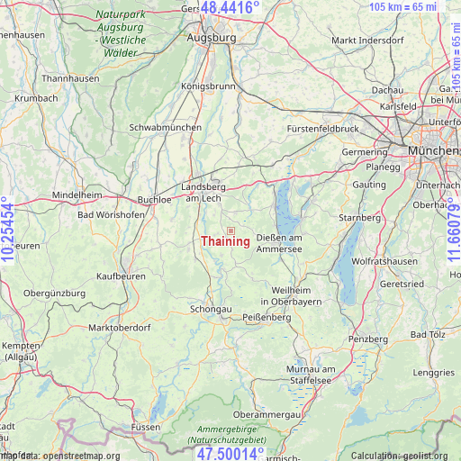
Thaining GPS coordinates[2]
47° 58' 22.872" North, 10° 57' 27.576" East
| Map corner | latitude | longitude |
|---|---|---|
| Upper-left | 48.4416°, | 10.25454° |
| Center: | 47.97302°, | 10.95766° |
| Lower-right: | 47.50014°, | 11.66079° |
| Map W x H: | 104.7×104.7 km | = 65.1×65.1mi |
| max Lat: | 55.01917° ⇑95.8% North |
| Thaining: | 47.97302° |
| min Lat: | ⇓4.2% South 47.40724° |
| min Long | Thaining | max Long |
| 5.92978° | 10.95766° | 14.98853° |
| W 66.3%⇐ | ⇒33.7% E |
Elevation
Elevation of Thaining is 689 m = 2260 ft, and this is 439.9 m = 1443 ft above average elevation for this country.
| Max E: |
1256 m = 4121 ft | 2.4% |
| Thaining | 689 m 2260 ft | |
| Avg. | 249.1 m = 817 ft | |
Min E: |
-5 m = -16 ft | 97.6% |
See also: Germany elevation on elevation.city.
Geographical zone
Thaining is located in North temperate zone (between Tropic of Cancer and the Arctic Circle). Distance of this North polar circle is 2067.1 km =1284.4 mi to North.| Distance of | km | miles | from Thaining |
|---|---|---|---|
| North Pole | 4673 | 2903.7 | to North |
| Arctic Circle | 2067.1 | 1284.4 | to North |
| Tropic Cancer | 2728.2 | 1695.2 | to South |
| Equator | 5334.1 | 3314.5 | to South |


Nearby cities:
15 places around Thaining: (largest is in red/bold)
• Apfeldorf
8.3 km =5.2 mi,  192°
192°
• Denklingen
10.2 km =6.3 mi,  231°
231°
• Dießen am Ammersee
11.1 km =6.9 mi,  102°
102°
• Hofstetten
4.1 km =2.5 mi,  14°
14°
• Kinsau
10.4 km =6.5 mi,  197°
197°
• Landsberg am Lech
10 km =6.2 mi,  326°
326°
• Penzing
11.5 km =7.1 mi,  348°
348°
• Pürgen
6.3 km =3.9 mi,  335°
335°
• Reichling
6 km =3.7 mi, 201°
• Rott
7.7 km =4.8 mi,  171°
171°
• Schwifting
8.4 km =5.2 mi, 344°
• Unterdießen
9.3 km =5.8 mi,  277°
277°
• Utting am Ammersee
11.2 km =7 mi,  58°
58°
• Vilgertshofen
4 km =2.5 mi, 230°
• Windach
11.8 km =7.3 mi,  28°
28°
Sources, notices
• [Note1] Compared only with cities in Germany existing in our database
• [Src1] Map data: © OpenStreetMap contributors (CC-BY-SA)
• [Src2] Other city data from geonames.org with taken over terms of usage.
• [Src3] Geographical zone / Annual Mean Temperature by Robert A. Rohde @ Wikipedia
