Sukow geodata
Sukow (Mecklenburg-Vorpommern) is a populated place; located in Germany in Europe/Berlin (GMT+2) time zone. With population of 1,505 people, there are 5871 cities with bigger population in this country. Compared to other cities in Germany, 86.1% of cities are located further ↓South; 75.2% of cities are located further ←West and 83.2% of cities have higher elevation than Sukow. Note1
Administrative division(s):
- Level 1: Mecklenburg-Vorpommern
- Level 3: Ludwigslust-Parchim
- Level 4: Sukow


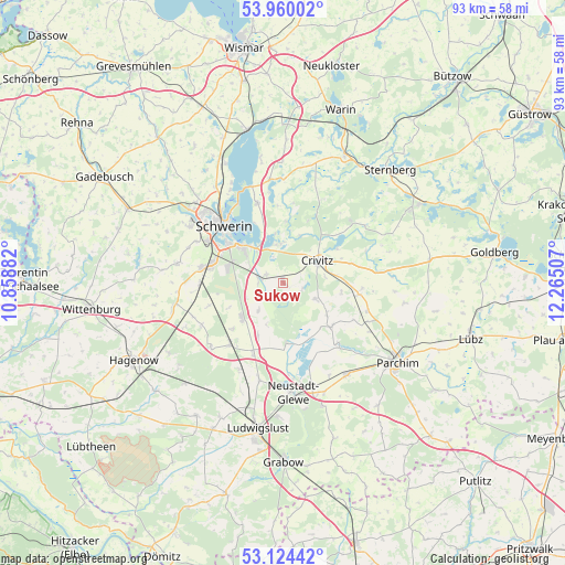
Sukow GPS coordinates[2]
53° 32' 39.408" North, 11° 33' 42.984" East
| Map corner | latitude | longitude |
|---|---|---|
| Upper-left | 53.96002°, | 10.85882° |
| Center: | 53.54428°, | 11.56194° |
| Lower-right: | 53.12442°, | 12.26507° |
| Map W x H: | 92.9×92.9 km | = 57.7×57.7mi |
| max Lat: | 55.01917° ⇑13.9% North |
| Sukow: | 53.54428° |
| min Lat: | ⇓86.1% South 47.40724° |
| min Long | Sukow | max Long |
| 5.92978° | 11.56194° | 14.98853° |
| W 75.2%⇐ | ⇒24.8% E |
Elevation
Elevation of Sukow is 39 m = 128 ft, and this is 210.1 m = 689 ft below average elevation for this country.
| Max E: |
1256 m = 4121 ft | 83.2% |
| Avg. | 249.1 m = 817 ft | |
| Sukow | 39 m = 128 ft | |
Min E: |
-5 m = -16 ft | 16.8% |
See also: Germany elevation on elevation.city.
Geographical zone
Sukow is located in North temperate zone (between Tropic of Cancer and the Arctic Circle). Distance of this North polar circle is 1447.6 km =899.5 mi to North.| Distance of | km | miles | from Sukow |
|---|---|---|---|
| North Pole | 4053.5 | 2518.7 | to North |
| Arctic Circle | 1447.6 | 899.5 | to North |
| Tropic Cancer | 3347.6 | 2080.1 | to South |
| Equator | 5953.6 | 3699.4 | to South |


Nearby cities:
15 places around Sukow: (largest is in red/bold)
• Banzkow
3.3 km =2.1 mi,  230°
230°
• Crivitz
6.8 km =4.2 mi,  61°
61°
• Friedrichsruhe
12.6 km =7.8 mi,  98°
98°
• Goldenstädt
9.5 km =5.9 mi,  205°
205°
• Lübesse
9.1 km =5.7 mi, 227°
• Mirow
5.8 km =3.6 mi,  221°
221°
• Pinnow
6.5 km =4 mi,  350°
350°
• Plate
3.6 km =2.2 mi,  282°
282°
• Raben Steinfeld
7.4 km =4.6 mi,  329°
329°
• Raduhn
10.7 km =6.6 mi,  130°
130°
• Rastow
13 km =8.1 mi, 221°
• Sülstorf
13 km =8.1 mi,  252°
252°
• Tramm
6.2 km =3.9 mi,  113°
113°
• Wessin
11.6 km =7.2 mi,  74°
74°
• Zapel
6.9 km =4.3 mi,  81°
81°
Sources, notices
• [Note1] Compared only with cities in Germany existing in our database
• [Src1] Map data: © OpenStreetMap contributors (CC-BY-SA)
• [Src2] Other city data from geonames.org with taken over terms of usage.
• [Src3] Geographical zone / Annual Mean Temperature by Robert A. Rohde @ Wikipedia
