Sülstorf geodata
Sülstorf (Mecklenburg-Vorpommern) is a populated place; located in Germany in Europe/Berlin (GMT+2) time zone. With population of 1,011 people, there are 7147 cities with bigger population in this country. Compared to other cities in Germany, 85.6% of cities are located further ↓South; 72.4% of cities are located further ←West and 80.6% of cities have higher elevation than Sülstorf. Note1
Administrative division(s):
- Level 1: Mecklenburg-Vorpommern
- Level 3: Ludwigslust-Parchim
- Level 4: Sülstorf


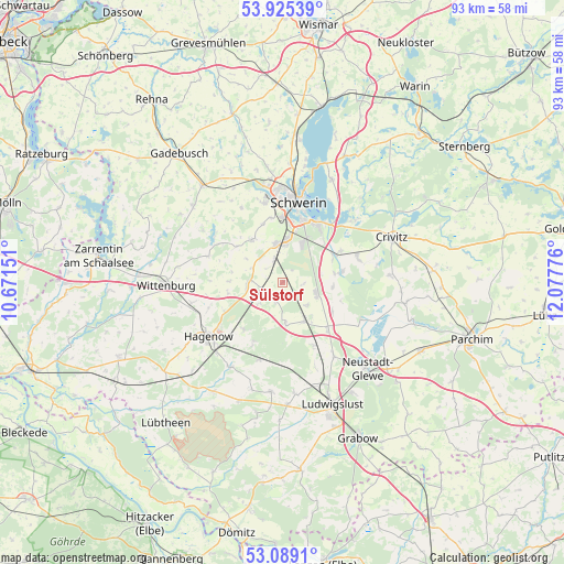
Sülstorf GPS coordinates[2]
53° 30' 33.516" North, 11° 22' 28.668" East
| Map corner | latitude | longitude |
|---|---|---|
| Upper-left | 53.92539°, | 10.67151° |
| Center: | 53.50931°, | 11.37463° |
| Lower-right: | 53.0891°, | 12.07776° |
| Map W x H: | 93×93 km | = 57.8×57.8mi |
| max Lat: | 55.01917° ⇑14.4% North |
| Sülstorf: | 53.50931° |
| min Lat: | ⇓85.6% South 47.40724° |
| min Long | Sülstorf | max Long |
| 5.92978° | 11.37463° | 14.98853° |
| W 72.4%⇐ | ⇒27.6% E |
Elevation
Elevation of Sülstorf is 45 m = 148 ft, and this is 204.1 m = 670 ft below average elevation for this country.
| Max E: |
1256 m = 4121 ft | 80.6% |
| Avg. | 249.1 m = 817 ft | |
| Sülstorf | 45 m = 148 ft | |
Min E: |
-5 m = -16 ft | 19.4% |
See also: Germany elevation on elevation.city.
Geographical zone
Sülstorf is located in North temperate zone (between Tropic of Cancer and the Arctic Circle). Distance of this North polar circle is 1451.5 km =901.9 mi to North.| Distance of | km | miles | from Sülstorf |
|---|---|---|---|
| North Pole | 4057.4 | 2521.2 | to North |
| Arctic Circle | 1451.5 | 901.9 | to North |
| Tropic Cancer | 3343.8 | 2077.7 | to South |
| Equator | 5949.7 | 3697 | to South |


Nearby cities:
15 places around Sülstorf: (largest is in red/bold)
• Banzkow
10 km =6.2 mi,  79°
79°
• Feldstadt
12.9 km =8 mi,  9°
9°
• Goldenstädt
9.5 km =5.9 mi,  119°
119°
• Holthusen
3.8 km =2.4 mi,  338°
338°
• Hoort
3.2 km =2 mi,  197°
197°
• Kirch Jesar
9.9 km =6.2 mi,  219°
219°
• Klein Rogahn
10.8 km =6.7 mi,  349°
349°
• Lübesse
6.2 km =3.9 mi,  111°
111°
• Lüblow
11.6 km =7.2 mi,  154°
154°
• Mirow
8.5 km =5.3 mi,  93°
93°
• Moraas
10.8 km =6.7 mi,  206°
206°
• Plate
10.1 km =6.3 mi,  62°
62°
• Rastow
6.9 km =4.3 mi, 147°
• Stralendorf
8.7 km =5.4 mi,  327°
327°
• Sukow
13 km =8.1 mi,  72°
72°
Sources, notices
• [Note1] Compared only with cities in Germany existing in our database
• [Src1] Map data: © OpenStreetMap contributors (CC-BY-SA)
• [Src2] Other city data from geonames.org with taken over terms of usage.
• [Src3] Geographical zone / Annual Mean Temperature by Robert A. Rohde @ Wikipedia
