Steinefrenz geodata
Steinefrenz (Rheinland-Pfalz) is a seat of a fourth-order administrative division; located in Germany in Europe/Berlin (GMT+2) time zone. With population of 753 people, there are 8083 cities with bigger population in this country. Compared to other cities in Germany, 53.6% of cities are located further ↑North; 78.5% of cities are located further →East and 58.8% of cities have lower elevation than Steinefrenz. Note1


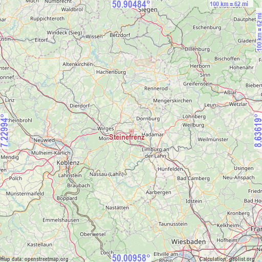
Steinefrenz GPS coordinates[2]
50° 27' 33.588" North, 7° 55' 59.052" East
| Map corner | latitude | longitude |
|---|---|---|
| Upper-left | 50.90484°, | 7.22994° |
| Center: | 50.45933°, | 7.93307° |
| Lower-right: | 50.00958°, | 8.63619° |
| Map W x H: | 99.5×99.5 km | = 61.8×61.8mi |
| max Lat: | 55.01917° ⇑53.6% North |
| Steinefrenz: | 50.45933° |
| min Lat: | ⇓46.4% South 47.40724° |
| min Long | Steinefrenz | max Long |
| 5.92978° | 7.93307° | 14.98853° |
| W 21.5%⇐ | ⇒78.5% E |
Elevation
Elevation of Steinefrenz is 283 m = 928 ft, and this is 33.9 m = 111 ft above average elevation for this country.
| Max E: |
1256 m = 4121 ft | 41.2% |
| Steinefrenz | 283 m 928 ft | |
| Avg. | 249.1 m = 817 ft | |
Min E: |
-5 m = -16 ft | 58.8% |
See also: Germany elevation on elevation.city.
Geographical zone
Steinefrenz is located in North temperate zone (between Tropic of Cancer and the Arctic Circle). Distance of this North polar circle is 1790.6 km =1112.6 mi to North.| Distance of | km | miles | from Steinefrenz |
|---|---|---|---|
| North Pole | 4396.5 | 2731.9 | to North |
| Arctic Circle | 1790.6 | 1112.6 | to North |
| Tropic Cancer | 3004.6 | 1867 | to South |
| Equator | 5610.6 | 3486.3 | to South |


Nearby cities:
15 places around Steinefrenz: (largest is in red/bold)
• Berod bei Wallmerod
2.7 km =1.7 mi,  0°
0°
• Bilkheim
4.4 km =2.7 mi,  14°
14°
• Dreikirchen
3.1 km =1.9 mi,  157°
157°
• Girod
1.6 km =1 mi,  228°
228°
• Großholbach
3.7 km =2.3 mi,  253°
253°
• Hundsangen
3.7 km =2.3 mi,  106°
106°
• Molsberg
4.4 km =2.7 mi,  53°
53°
• Nentershausen
4.7 km =2.9 mi,  179°
179°
• Niedererbach
4.7 km =2.9 mi,  141°
141°
• Nomborn
3.1 km =1.9 mi,  201°
201°
• Obererbach
2.6 km =1.6 mi, 113°
• Ruppach-Goldhausen
3.6 km =2.2 mi,  283°
283°
• Wallmerod
2.9 km =1.8 mi,  24°
24°
• Weroth
1.1 km =0.7 mi,  83°
83°
• Zehnhausen bei Wallmerod
2 km =1.2 mi,  340°
340°
Sources, notices
• [Note1] Compared only with cities in Germany existing in our database
• [Src1] Map data: © OpenStreetMap contributors (CC-BY-SA)
• [Src2] Other city data from geonames.org with taken over terms of usage.
• [Src3] Geographical zone / Annual Mean Temperature by Robert A. Rohde @ Wikipedia
