Ruppach-Goldhausen geodata
Ruppach-Goldhausen (Rheinland-Pfalz) is a seat of a fourth-order administrative division; located in Germany in Europe/Berlin (GMT+2) time zone. With population of 1,155 people, there are 6689 cities with bigger population in this country. Compared to other cities in Germany, 53.5% of cities are located further ↑North; 79.4% of cities are located further →East and 61.9% of cities have lower elevation than Ruppach-Goldhausen. Note1
Administrative division(s):
- Level 1: Rheinland-Pfalz
- Level 3: Westerwaldkreis
- Level 4: Ruppach-Goldhausen


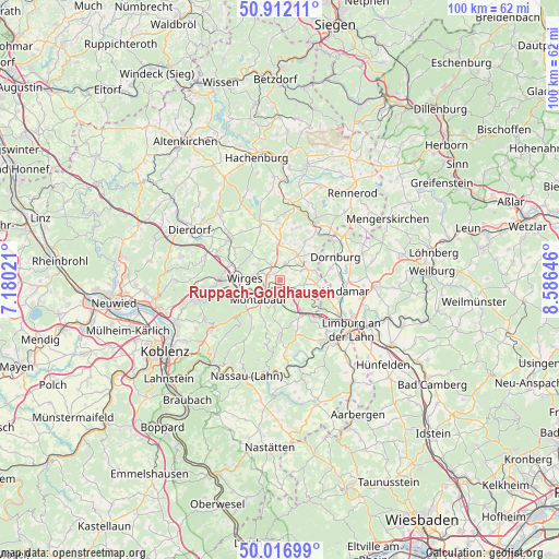
Ruppach-Goldhausen GPS coordinates[2]
50° 28' 0.012" North, 7° 52' 59.988" East
| Map corner | latitude | longitude |
|---|---|---|
| Upper-left | 50.91211°, | 7.18021° |
| Center: | 50.46667°, | 7.88333° |
| Lower-right: | 50.01699°, | 8.58646° |
| Map W x H: | 99.5×99.5 km | = 61.8×61.8mi |
| max Lat: | 55.01917° ⇑53.5% North |
| Ruppach-Goldhausen: | 50.46667° |
| min Lat: | ⇓46.5% South 47.40724° |
| min Long | Ruppach-Goldhau | max Long |
| 5.92978° | 7.88333° | 14.98853° |
| W 20.6%⇐ | ⇒79.4% E |
Elevation
Elevation of Ruppach-Goldhausen is 301 m = 988 ft, and this is 51.9 m = 170 ft above average elevation for this country.
| Max E: |
1256 m = 4121 ft | 38.1% |
| Ruppach-Goldhausen | 301 m 988 ft | |
| Avg. | 249.1 m = 817 ft | |
Min E: |
-5 m = -16 ft | 61.9% |
See also: Germany elevation on elevation.city.
Geographical zone
Ruppach-Goldhausen is located in North temperate zone (between Tropic of Cancer and the Arctic Circle). Distance of this North polar circle is 1789.8 km =1112.1 mi to North.| Distance of | km | miles | from Ruppach-Goldhausen |
|---|---|---|---|
| North Pole | 4395.7 | 2731.4 | to North |
| Arctic Circle | 1789.8 | 1112.1 | to North |
| Tropic Cancer | 3005.4 | 1867.5 | to South |
| Equator | 5611.4 | 3486.8 | to South |


Nearby cities:
15 places around Ruppach-Goldhausen: (largest is in red/bold)
• Bannberscheid
3.4 km =2.1 mi,  279°
279°
• Berod bei Wallmerod
4 km =2.5 mi,  62°
62°
• Boden
2 km =1.2 mi,  293°
293°
• Girod
3 km =1.9 mi,  128°
128°
• Großholbach
1.9 km =1.2 mi,  180°
180°
• Heiligenroth
2.2 km =1.4 mi,  212°
212°
• Meudt
3.7 km =2.3 mi,  12°
12°
• Moschheim
3.4 km =2.1 mi,  300°
300°
• Niederahr
3.2 km =2 mi,  330°
330°
• Nomborn
4.4 km =2.7 mi,  147°
147°
• Oberahr
3.9 km =2.4 mi,  342°
342°
• Staudt
3.5 km =2.2 mi,  270°
270°
• Steinefrenz
3.6 km =2.2 mi,  103°
103°
• Weroth
4.7 km =2.9 mi, 98°
• Zehnhausen bei Wallmerod
3 km =1.9 mi,  69°
69°
Sources, notices
• [Note1] Compared only with cities in Germany existing in our database
• [Src1] Map data: © OpenStreetMap contributors (CC-BY-SA)
• [Src2] Other city data from geonames.org with taken over terms of usage.
• [Src3] Geographical zone / Annual Mean Temperature by Robert A. Rohde @ Wikipedia
