Stein-Bockenheim geodata
Stein-Bockenheim (Rheinland-Pfalz) is a seat of a fourth-order administrative division; located in Germany in Europe/Berlin (GMT+2) time zone. With population of 688 people, there are 8369 cities with bigger population in this country. Compared to other cities in Germany, 69.8% of cities are located further ↑North; 77.8% of cities are located further →East and 50% of cities have lower elevation than Stein-Bockenheim. Note1
Administrative division(s):
- Level 1: Rheinland-Pfalz
- Level 3: Landkreis Alzey-Worms
- Level 4: Stein-Bockenheim


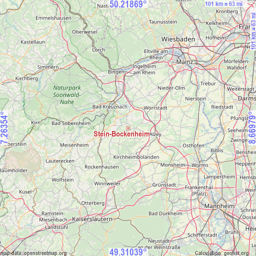
Stein-Bockenheim GPS coordinates[2]
49° 46' 0.012" North, 7° 58' 0.012" East
| Map corner | latitude | longitude |
|---|---|---|
| Upper-left | 50.21869°, | 7.26354° |
| Center: | 49.76667°, | 7.96667° |
| Lower-right: | 49.31039°, | 8.66979° |
| Map W x H: | 101×101 km | = 62.8×62.8mi |
| max Lat: | 55.01917° ⇑69.8% North |
| Stein-Bockenheim: | 49.76667° |
| min Lat: | ⇓30.2% South 47.40724° |
| min Long | Stein-Bockenhei | max Long |
| 5.92978° | 7.96667° | 14.98853° |
| W 22.2%⇐ | ⇒77.8% E |
Elevation
Elevation of Stein-Bockenheim is 225 m = 738 ft, and this is 24.1 m = 79 ft below average elevation for this country.
| Max E: |
1256 m = 4121 ft | 50% |
| Avg. | 249.1 m = 817 ft | |
| Stein-Bockenheim | 225 m = 738 ft | |
Min E: |
-5 m = -16 ft | 50% |
See also: Germany elevation on elevation.city.
Geographical zone
Stein-Bockenheim is located in North temperate zone (between Tropic of Cancer and the Arctic Circle). Distance of this North polar circle is 1867.6 km =1160.5 mi to North.| Distance of | km | miles | from Stein-Bockenheim |
|---|---|---|---|
| North Pole | 4473.5 | 2779.7 | to North |
| Arctic Circle | 1867.6 | 1160.5 | to North |
| Tropic Cancer | 2927.6 | 1819.1 | to South |
| Equator | 5533.5 | 3438.4 | to South |


Nearby cities:
15 places around Stein-Bockenheim: (largest is in red/bold)
• Bechenheim
5 km =3.1 mi,  148°
148°
• Eckelsheim
3.9 km =2.4 mi,  17°
17°
• Erbes-Büdesheim
4.8 km =3 mi,  106°
106°
• Flonheim
5.6 km =3.5 mi,  68°
68°
• Fürfeld
5.4 km =3.4 mi,  282°
282°
• Mörsfeld
3 km =1.9 mi,  232°
232°
• Nack
3.4 km =2.1 mi,  131°
131°
• Neu-Bamberg
4.7 km =2.9 mi,  319°
319°
• Nieder-Wiesen
3.9 km =2.4 mi,  162°
162°
• Niederhausen an der Appel
5.1 km =3.2 mi,  248°
248°
• Siefersheim
3.9 km =2.4 mi,  342°
342°
• Tiefenthal
5.1 km =3.2 mi, 248°
• Wendelsheim
2.4 km =1.5 mi,  90°
90°
• Wonsheim
1.9 km =1.2 mi,  0°
0°
• Wöllstein
5.6 km =3.5 mi, 0°
Sources, notices
• [Note1] Compared only with cities in Germany existing in our database
• [Src1] Map data: © OpenStreetMap contributors (CC-BY-SA)
• [Src2] Other city data from geonames.org with taken over terms of usage.
• [Src3] Geographical zone / Annual Mean Temperature by Robert A. Rohde @ Wikipedia
