Erbes-Büdesheim geodata
Erbes-Büdesheim (Rheinland-Pfalz) is a seat of a fourth-order administrative division; located in Germany in Europe/Berlin (GMT+2) time zone. With population of 1,385 people, there are 6104 cities with bigger population in this country. Compared to other cities in Germany, 70% of cities are located further ↑North; 76.6% of cities are located further →East and 55.6% of cities have lower elevation than Erbes-Büdesheim. Note1
Administrative division(s):
- Level 1: Rheinland-Pfalz
- Level 3: Landkreis Alzey-Worms
- Level 4: Erbes-Büdesheim


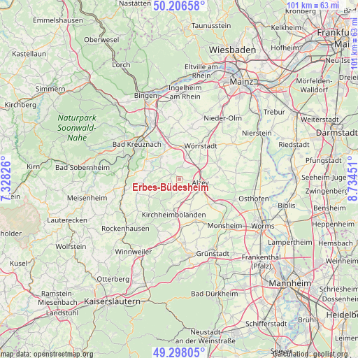
Erbes-Büdesheim GPS coordinates[2]
49° 45' 15.984" North, 8° 1' 53.004" East
| Map corner | latitude | longitude |
|---|---|---|
| Upper-left | 50.20658°, | 7.32826° |
| Center: | 49.75444°, | 8.03139° |
| Lower-right: | 49.29805°, | 8.73451° |
| Map W x H: | 101×101 km | = 62.8×62.8mi |
| max Lat: | 55.01917° ⇑70% North |
| Erbes-Büdesheim: | 49.75444° |
| min Lat: | ⇓30% South 47.40724° |
| min Long | Erbes-Büdeshei | max Long |
| 5.92978° | 8.03139° | 14.98853° |
| W 23.4%⇐ | ⇒76.6% E |
Elevation
Elevation of Erbes-Büdesheim is 262 m = 860 ft, and this is 12.9 m = 42 ft above average elevation for this country.
| Max E: |
1256 m = 4121 ft | 44.4% |
| Erbes-Büdesheim | 262 m 860 ft | |
| Avg. | 249.1 m = 817 ft | |
Min E: |
-5 m = -16 ft | 55.6% |
See also: Germany elevation on elevation.city.
Geographical zone
Erbes-Büdesheim is located in North temperate zone (between Tropic of Cancer and the Arctic Circle). Distance of this North polar circle is 1869 km =1161.3 mi to North.| Distance of | km | miles | from Erbes-Büdesheim |
|---|---|---|---|
| North Pole | 4474.9 | 2780.6 | to North |
| Arctic Circle | 1869 | 1161.3 | to North |
| Tropic Cancer | 2926.3 | 1818.3 | to South |
| Equator | 5532.2 | 3437.5 | to South |


Nearby cities:
15 places around Erbes-Büdesheim: (largest is in red/bold)
• Alzey
6.1 km =3.8 mi,  98°
98°
• Armsheim
6.4 km =4 mi,  16°
16°
• Bechenheim
3.5 km =2.2 mi,  215°
215°
• Bornheim
3.8 km =2.4 mi,  33°
33°
• Eckelsheim
6.1 km =3.8 mi,  325°
325°
• Flonheim
3.5 km =2.2 mi,  10°
10°
• Lonsheim
4.2 km =2.6 mi,  50°
50°
• Mauchenheim
4.2 km =2.6 mi,  165°
165°
• Morschheim
6.4 km =4 mi,  183°
183°
• Nack
2.2 km =1.4 mi,  246°
246°
• Nieder-Wiesen
4.2 km =2.6 mi,  235°
235°
• Offenheim
3.2 km =2 mi, 181°
• Stein-Bockenheim
4.8 km =3 mi,  286°
286°
• Wendelsheim
2.6 km =1.6 mi,  301°
301°
• Wonsheim
5.6 km =3.5 mi, 304°
Sources, notices
• [Note1] Compared only with cities in Germany existing in our database
• [Src1] Map data: © OpenStreetMap contributors (CC-BY-SA)
• [Src2] Other city data from geonames.org with taken over terms of usage.
• [Src3] Geographical zone / Annual Mean Temperature by Robert A. Rohde @ Wikipedia
