Sinnersdorf geodata
Sinnersdorf (North Rhine-Westphalia) is a populated place; located in Germany in Europe/Berlin (GMT+2) time zone. With population of 5,727 people, there are 2553 cities with bigger population in this country. Compared to other cities in Germany, 58.5% of cities are located further ↓South; 95.4% of cities are located further →East and 80.2% of cities have higher elevation than Sinnersdorf. Note1
Administrative division(s):
- Level 1: North Rhine-Westphalia
- Level 2: Regierungsbezirk Köln
- Level 3: Rhein-Erft-Kreis
- Level 4: Pulheim


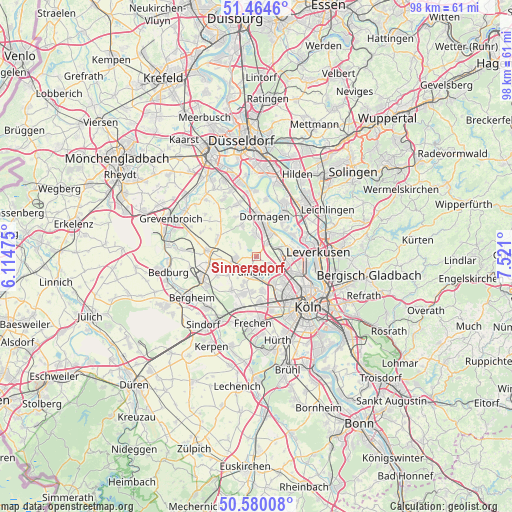
Sinnersdorf GPS coordinates[2]
51° 1' 28.02" North, 6° 49' 4.332" East
| Map corner | latitude | longitude |
|---|---|---|
| Upper-left | 51.4646°, | 6.11475° |
| Center: | 51.02445°, | 6.81787° |
| Lower-right: | 50.58008°, | 7.521° |
| Map W x H: | 98.3×98.3 km | = 61.1×61.1mi |
| max Lat: | 55.01917° ⇑41.5% North |
| Sinnersdorf: | 51.02445° |
| min Lat: | ⇓58.5% South 47.40724° |
| min Long | Sinnersdorf | max Long |
| 5.92978° | 6.81787° | 14.98853° |
| W 4.6%⇐ | ⇒95.4% E |
Elevation
Elevation of Sinnersdorf is 46 m = 151 ft, and this is 203.1 m = 666 ft below average elevation for this country.
| Max E: |
1256 m = 4121 ft | 80.2% |
| Avg. | 249.1 m = 817 ft | |
| Sinnersdorf | 46 m = 151 ft | |
Min E: |
-5 m = -16 ft | 19.8% |
See also: Germany elevation on elevation.city.
Geographical zone
Sinnersdorf is located in North temperate zone (between Tropic of Cancer and the Arctic Circle). Distance of this North polar circle is 1727.8 km =1073.6 mi to North.| Distance of | km | miles | from Sinnersdorf |
|---|---|---|---|
| North Pole | 4333.7 | 2692.8 | to North |
| Arctic Circle | 1727.8 | 1073.6 | to North |
| Tropic Cancer | 3067.5 | 1906.1 | to South |
| Equator | 5673.4 | 3525.3 | to South |


Nearby cities:
15 places around Sinnersdorf: (largest is in red/bold)
• Altstadt Nord
13.6 km =8.5 mi,  134°
134°
• Bilderstoeckchen
9.9 km =6.2 mi, 127°
• Dormagen
8.1 km =5 mi,  6°
6°
• Frechen
12.2 km =7.6 mi,  181°
181°
• Langenfeld
13 km =8.1 mi,  44°
44°
• Leverkusen
11.7 km =7.3 mi,  86°
86°
• Mengenich
6.2 km =3.9 mi,  145°
145°
• Monheim am Rhein
9.1 km =5.7 mi,  34°
34°
• Neuehrenfeld
11.1 km =6.9 mi, 131°
• Neustadt/Nord
12.4 km =7.7 mi, 132°
• Nippes
11.5 km =7.1 mi,  124°
124°
• Ossendorf
8.6 km =5.3 mi, 134°
• Pulheim
2.9 km =1.8 mi,  196°
196°
• Riehl
12.8 km =8 mi, 120°
• Rommerskirchen
9.5 km =5.9 mi,  275°
275°
Sources, notices
• [Note1] Compared only with cities in Germany existing in our database
• [Src1] Map data: © OpenStreetMap contributors (CC-BY-SA)
• [Src2] Other city data from geonames.org with taken over terms of usage.
• [Src3] Geographical zone / Annual Mean Temperature by Robert A. Rohde @ Wikipedia
