Bilderstoeckchen geodata
Bilderstoeckchen (North Rhine-Westphalia) is a section of populated place; located in Germany in Europe/Berlin (GMT+2) time zone. With population of 15,430 people, there are 1037 cities with bigger population in this country. Compared to other cities in Germany, 57.6% of cities are located further ↓South; 94.2% of cities are located further →East and 78.7% of cities have higher elevation than Bilderstoeckchen. Note1
Administrative division(s):
- Level 1: North Rhine-Westphalia
- Level 2: Regierungsbezirk Köln
- Level 3: Kreisfreie Stadt Köln
- Level 4: Köln


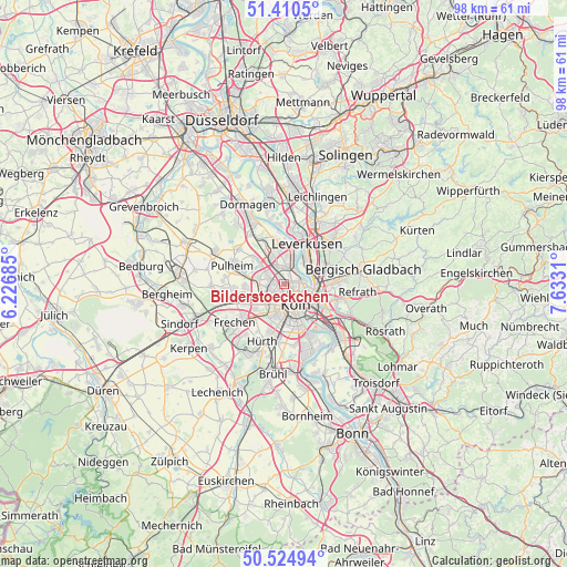
Bilderstoeckchen GPS coordinates[2]
50° 58' 11.388" North, 6° 55' 47.892" East
| Map corner | latitude | longitude |
|---|---|---|
| Upper-left | 51.4105°, | 6.22685° |
| Center: | 50.96983°, | 6.92997° |
| Lower-right: | 50.52494°, | 7.6331° |
| Map W x H: | 98.5×98.5 km | = 61.2×61.2mi |
| max Lat: | 55.01917° ⇑42.4% North |
| Bilderstoeckchen: | 50.96983° |
| min Lat: | ⇓57.6% South 47.40724° |
| min Long | Bilderstoeckche | max Long |
| 5.92978° | 6.92997° | 14.98853° |
| W 5.8%⇐ | ⇒94.2% E |
Elevation
Elevation of Bilderstoeckchen is 51 m = 167 ft, and this is 198.1 m = 650 ft below average elevation for this country.
| Max E: |
1256 m = 4121 ft | 78.7% |
| Avg. | 249.1 m = 817 ft | |
| Bilderstoeckchen | 51 m = 167 ft | |
Min E: |
-5 m = -16 ft | 21.3% |
See also: Germany elevation on elevation.city.
Geographical zone
Bilderstoeckchen is located in North temperate zone (between Tropic of Cancer and the Arctic Circle). Distance of this North polar circle is 1733.9 km =1077.4 mi to North.| Distance of | km | miles | from Bilderstoeckchen |
|---|---|---|---|
| North Pole | 4339.7 | 2696.6 | to North |
| Arctic Circle | 1733.9 | 1077.4 | to North |
| Tropic Cancer | 3061.4 | 1902.3 | to South |
| Equator | 5667.3 | 3521.5 | to South |


Nearby cities:
15 places around Bilderstoeckchen: (largest is in red/bold)
• Altstadt Nord
3.9 km =2.4 mi,  150°
150°
• Altstadt Sud
4.6 km =2.9 mi, 152°
• Buchforst
5.7 km =3.5 mi,  111°
111°
• Deutz
5 km =3.1 mi,  141°
141°
• Humboldtkolonie
6.2 km =3.9 mi,  132°
132°
• Kalk
6.3 km =3.9 mi,  121°
121°
• Köln
4.3 km =2.7 mi,  160°
160°
• Mengenich
4.5 km =2.8 mi,  282°
282°
• Mülheim
5.2 km =3.2 mi,  94°
94°
• Neuehrenfeld
1.4 km =0.9 mi, 162°
• Neustadt/Nord
2.6 km =1.6 mi, 151°
• Neustadt/Süd
5.1 km =3.2 mi,  166°
166°
• Nippes
1.7 km =1.1 mi, 106°
• Ossendorf
1.7 km =1.1 mi,  272°
272°
• Riehl
3.2 km =2 mi,  95°
95°
Sources, notices
• [Note1] Compared only with cities in Germany existing in our database
• [Src1] Map data: © OpenStreetMap contributors (CC-BY-SA)
• [Src2] Other city data from geonames.org with taken over terms of usage.
• [Src3] Geographical zone / Annual Mean Temperature by Robert A. Rohde @ Wikipedia
