Siek geodata
Siek (Schleswig-Holstein) is a seat of a fourth-order administrative division; located in Germany in Europe/Berlin (GMT+2) time zone. With population of 1,958 people, there are 5120 cities with bigger population in this country. Compared to other cities in Germany, 87.5% of cities are located further ↓South; 55.3% of cities are located further ←West and 74.7% of cities have higher elevation than Siek. Note1


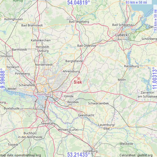
Siek GPS coordinates[2]
53° 37' 59.988" North, 10° 18' 0" East
| Map corner | latitude | longitude |
|---|---|---|
| Upper-left | 54.04819°, | 9.59688° |
| Center: | 53.63333°, | 10.3° |
| Lower-right: | 53.21435°, | 11.00313° |
| Map W x H: | 92.7×92.7 km | = 57.6×57.6mi |
| max Lat: | 55.01917° ⇑12.5% North |
| Siek: | 53.63333° |
| min Lat: | ⇓87.5% South 47.40724° |
| min Long | Siek | max Long |
| 5.92978° | 10.3° | 14.98853° |
| W 55.3%⇐ | ⇒44.7% E |
Elevation
Elevation of Siek is 64 m = 210 ft, and this is 185.1 m = 607 ft below average elevation for this country.
| Max E: |
1256 m = 4121 ft | 74.7% |
| Avg. | 249.1 m = 817 ft | |
| Siek | 64 m = 210 ft | |
Min E: |
-5 m = -16 ft | 25.3% |
See also: Germany elevation on elevation.city.
Geographical zone
Siek is located in North temperate zone (between Tropic of Cancer and the Arctic Circle). Distance of this North polar circle is 1437.7 km =893.3 mi to North.| Distance of | km | miles | from Siek |
|---|---|---|---|
| North Pole | 4043.6 | 2512.6 | to North |
| Arctic Circle | 1437.7 | 893.3 | to North |
| Tropic Cancer | 3357.5 | 2086.3 | to South |
| Equator | 5963.5 | 3705.5 | to South |


Nearby cities:
15 places around Siek: (largest is in red/bold)
• Ahrensburg
6.7 km =4.2 mi,  313°
313°
• Braak
4.4 km =2.7 mi,  234°
234°
• Delingsdorf
8.1 km =5 mi,  336°
336°
• Grande
7.8 km =4.8 mi,  135°
135°
• Großensee
3.5 km =2.2 mi,  131°
131°
• Großhansdorf
3.9 km =2.4 mi, 343°
• Grönwohld
7.2 km =4.5 mi,  82°
82°
• Hoisdorf
2.2 km =1.4 mi,  30°
30°
• Kuddewörde
8.6 km =5.3 mi, 130°
• Lütjensee
4.8 km =3 mi,  67°
67°
• Rausdorf
5.3 km =3.3 mi,  157°
157°
• Stapelfeld
6.6 km =4.1 mi,  236°
236°
• Todendorf
7.5 km =4.7 mi,  24°
24°
• Trittau
6.8 km =4.2 mi,  105°
105°
• Witzhave
7.7 km =4.8 mi, 163°
Sources, notices
• [Note1] Compared only with cities in Germany existing in our database
• [Src1] Map data: © OpenStreetMap contributors (CC-BY-SA)
• [Src2] Other city data from geonames.org with taken over terms of usage.
• [Src3] Geographical zone / Annual Mean Temperature by Robert A. Rohde @ Wikipedia
