Schwarza geodata
Schwarza (Thuringia) is a seat of a fourth-order administrative division; located in Germany in Europe/Berlin (GMT+2) time zone. In our database, there are 11009 cities with bigger population. Compared to other cities in Germany, 50% of cities are located further ↓South; 59.4% of cities are located further ←West and 69.4% of cities have lower elevation than Schwarza. Note1
Administrative division(s):
- Level 1: Thuringia
- Level 3: Landkreis Schmalkalden-Meiningen
- Level 4: Schwarza


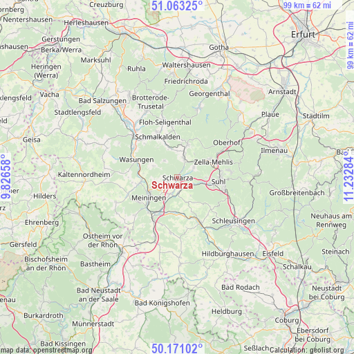
Schwarza GPS coordinates[2]
50° 37' 9.3" North, 10° 31' 46.956" East
| Map corner | latitude | longitude |
|---|---|---|
| Upper-left | 51.06325°, | 9.82658° |
| Center: | 50.61925°, | 10.52971° |
| Lower-right: | 50.17102°, | 11.23284° |
| Map W x H: | 99.2×99.2 km | = 61.6×61.6mi |
| max Lat: | 55.01917° ⇑50% North |
| Schwarza: | 50.61925° |
| min Lat: | ⇓50% South 47.40724° |
| min Long | Schwarza | max Long |
| 5.92978° | 10.52971° | 14.98853° |
| W 59.4%⇐ | ⇒40.6% E |
Elevation
Elevation of Schwarza is 354 m = 1161 ft, and this is 104.9 m = 344 ft above average elevation for this country.
| Max E: |
1256 m = 4121 ft | 30.6% |
| Schwarza | 354 m 1161 ft | |
| Avg. | 249.1 m = 817 ft | |
Min E: |
-5 m = -16 ft | 69.4% |
See also: Germany elevation on elevation.city.
Geographical zone
Schwarza is located in North temperate zone (between Tropic of Cancer and the Arctic Circle). Distance of this North polar circle is 1772.8 km =1101.6 mi to North.| Distance of | km | miles | from Schwarza |
|---|---|---|---|
| North Pole | 4378.7 | 2720.8 | to North |
| Arctic Circle | 1772.8 | 1101.6 | to North |
| Tropic Cancer | 3022.4 | 1878 | to South |
| Equator | 5628.3 | 3497.3 | to South |


Nearby cities:
15 places around Schwarza: (largest is in red/bold)
• Benshausen
6 km =3.7 mi,  55°
55°
• Bermbach
8 km =5 mi,  35°
35°
• Breitenbach
8.2 km =5.1 mi,  340°
340°
• Christes
6.2 km =3.9 mi,  328°
328°
• Dillstädt
4 km =2.5 mi,  176°
176°
• Kühndorf
3.1 km =1.9 mi,  247°
247°
• Marisfeld
7.7 km =4.8 mi,  156°
156°
• Metzels
7.4 km =4.6 mi,  294°
294°
• Oberstadt
8.6 km =5.3 mi,  145°
145°
• Rohr
5.3 km =3.3 mi,  205°
205°
• Schmeheim
7 km =4.3 mi, 147°
• Springstille
7.6 km =4.7 mi,  359°
359°
• Steinbach-Hallenberg
8.9 km =5.5 mi,  16°
16°
• Utendorf
6.8 km =4.2 mi,  267°
267°
• Viernau
5.2 km =3.2 mi, 22°
Sources, notices
• [Note1] Compared only with cities in Germany existing in our database
• [Src1] Map data: © OpenStreetMap contributors (CC-BY-SA)
• [Src2] Other city data from geonames.org with taken over terms of usage.
• [Src3] Geographical zone / Annual Mean Temperature by Robert A. Rohde @ Wikipedia
