Rohr geodata
Rohr (Thuringia) is a seat of a fourth-order administrative division; located in Germany in Europe/Berlin (GMT+2) time zone. With population of 1,062 people, there are 6958 cities with bigger population in this country. Compared to other cities in Germany, 51.1% of cities are located further ↑North; 58.9% of cities are located further ←West and 67.7% of cities have lower elevation than Rohr. Note1
Administrative division(s):
- Level 1: Thuringia
- Level 3: Landkreis Schmalkalden-Meiningen
- Level 4: Rohr


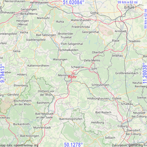
Rohr GPS coordinates[2]
50° 34' 35.184" North, 10° 29' 50.1" East
| Map corner | latitude | longitude |
|---|---|---|
| Upper-left | 51.02084°, | 9.79413° |
| Center: | 50.57644°, | 10.49725° |
| Lower-right: | 50.1278°, | 11.20038° |
| Map W x H: | 99.3×99.3 km | = 61.7×61.7mi |
| max Lat: | 55.01917° ⇑51.1% North |
| Rohr: | 50.57644° |
| min Lat: | ⇓48.9% South 47.40724° |
| min Long | Rohr | max Long |
| 5.92978° | 10.49725° | 14.98853° |
| W 58.9%⇐ | ⇒41.1% E |
Elevation
Elevation of Rohr is 341 m = 1119 ft, and this is 91.9 m = 302 ft above average elevation for this country.
| Max E: |
1256 m = 4121 ft | 32.3% |
| Rohr | 341 m 1119 ft | |
| Avg. | 249.1 m = 817 ft | |
Min E: |
-5 m = -16 ft | 67.7% |
See also: Germany elevation on elevation.city.
Geographical zone
Rohr is located in North temperate zone (between Tropic of Cancer and the Arctic Circle). Distance of this North polar circle is 1777.6 km =1104.5 mi to North.| Distance of | km | miles | from Rohr |
|---|---|---|---|
| North Pole | 4383.5 | 2723.8 | to North |
| Arctic Circle | 1777.6 | 1104.5 | to North |
| Tropic Cancer | 3017.7 | 1875.1 | to South |
| Equator | 5623.6 | 3494.3 | to South |


Nearby cities:
15 places around Rohr: (largest is in red/bold)
• Belrieth
5.3 km =3.3 mi,  181°
181°
• Dillstädt
2.7 km =1.7 mi,  73°
73°
• Einhausen
5.9 km =3.7 mi,  205°
205°
• Ellingshausen
3.6 km =2.2 mi,  216°
216°
• Kühndorf
3.6 km =2.2 mi,  351°
351°
• Leutersdorf
7.6 km =4.7 mi,  150°
150°
• Marisfeld
5.8 km =3.6 mi,  113°
113°
• Meiningen
5.9 km =3.7 mi,  260°
260°
• Obermaßfeld-Grimmenthal
6.7 km =4.2 mi, 217°
• Oberstadt
7.5 km =4.7 mi, 108°
• Schmeheim
6.2 km =3.9 mi,  100°
100°
• Schwarza
5.3 km =3.3 mi,  25°
25°
• Untermaßfeld
7.4 km =4.6 mi,  229°
229°
• Utendorf
6.4 km =4 mi,  314°
314°
• Vachdorf
6.3 km =3.9 mi, 153°
Sources, notices
• [Note1] Compared only with cities in Germany existing in our database
• [Src1] Map data: © OpenStreetMap contributors (CC-BY-SA)
• [Src2] Other city data from geonames.org with taken over terms of usage.
• [Src3] Geographical zone / Annual Mean Temperature by Robert A. Rohde @ Wikipedia
