Steinbach-Hallenberg geodata
Steinbach-Hallenberg (Thuringia) is a populated place; located in Germany in Europe/Berlin (GMT+2) time zone. With population of 5,053 people, there are 2807 cities with bigger population in this country. Compared to other cities in Germany, 51.9% of cities are located further ↓South; 60.1% of cities are located further ←West and 80.3% of cities have lower elevation than Steinbach-Hallenberg. Note1
Administrative division(s):
- Level 1: Thuringia
- Level 3: Landkreis Schmalkalden-Meiningen
- Level 4: Steinbach-Hallenberg, Kurort


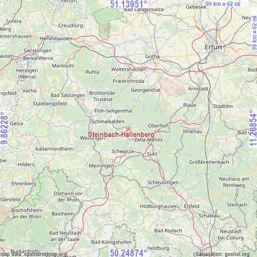
Steinbach-Hallenberg GPS coordinates[2]
50° 41' 46.464" North, 10° 33' 55.476" East
| Map corner | latitude | longitude |
|---|---|---|
| Upper-left | 51.13951°, | 9.86228° |
| Center: | 50.69624°, | 10.56541° |
| Lower-right: | 50.24874°, | 11.26854° |
| Map W x H: | 99×99 km | = 61.5×61.5mi |
| max Lat: | 55.01917° ⇑48.1% North |
| Steinbach-Hallenberg: | 50.69624° |
| min Lat: | ⇓51.9% South 47.40724° |
| min Long | Steinbach-Halle | max Long |
| 5.92978° | 10.56541° | 14.98853° |
| W 60.1%⇐ | ⇒39.9% E |
Elevation
Elevation of Steinbach-Hallenberg is 435 m = 1427 ft, and this is 185.9 m = 610 ft above average elevation for this country.
| Max E: |
1256 m = 4121 ft | 19.7% |
| Steinbach-Hallenberg | 435 m 1427 ft | |
| Avg. | 249.1 m = 817 ft | |
Min E: |
-5 m = -16 ft | 80.3% |
See also: Germany elevation on elevation.city.
Geographical zone
Steinbach-Hallenberg is located in North temperate zone (between Tropic of Cancer and the Arctic Circle). Distance of this North polar circle is 1764.3 km =1096.3 mi to North.| Distance of | km | miles | from Steinbach-Hallenberg |
|---|---|---|---|
| North Pole | 4370.2 | 2715.5 | to North |
| Arctic Circle | 1764.3 | 1096.3 | to North |
| Tropic Cancer | 3031 | 1883.4 | to South |
| Equator | 5636.9 | 3502.6 | to South |


Nearby cities:
15 places around Steinbach-Hallenberg: (largest is in red/bold)
• Altersbach
2.3 km =1.4 mi,  280°
280°
• Benshausen
5.7 km =3.5 mi,  154°
154°
• Bermbach
3 km =1.9 mi,  133°
133°
• Breitenbach
5.3 km =3.3 mi,  261°
261°
• Christes
6.7 km =4.2 mi,  240°
240°
• Kühndorf
11.1 km =6.9 mi,  208°
208°
• Metzels
10.7 km =6.6 mi, 239°
• Oberschönau
4.3 km =2.7 mi,  57°
57°
• Rotterode
2 km =1.2 mi,  335°
335°
• Schmalkalden
9 km =5.6 mi,  288°
288°
• Schwarza
8.9 km =5.5 mi,  196°
196°
• Springstille
2.8 km =1.7 mi,  248°
248°
• Unterschönau
2.6 km =1.6 mi,  29°
29°
• Viernau
3.8 km =2.4 mi,  188°
188°
• Zella-Mehlis
8 km =5 mi,  123°
123°
Sources, notices
• [Note1] Compared only with cities in Germany existing in our database
• [Src1] Map data: © OpenStreetMap contributors (CC-BY-SA)
• [Src2] Other city data from geonames.org with taken over terms of usage.
• [Src3] Geographical zone / Annual Mean Temperature by Robert A. Rohde @ Wikipedia
