Schwaigern geodata
Schwaigern (Baden-Württemberg) is a populated place; located in Germany in Europe/Berlin (GMT+2) time zone. With population of 11,047 people, there are 1496 cities with bigger population in this country. Compared to other cities in Germany, 81.2% of cities are located further ↑North; 64.7% of cities are located further →East and 53.2% of cities have higher elevation than Schwaigern. Note1
Administrative division(s):
- Level 1: Baden-Württemberg
- Level 2: Regierungsbezirk Stuttgart
- Level 3: Landkreis Heilbronn
- Level 4: Schwaigern


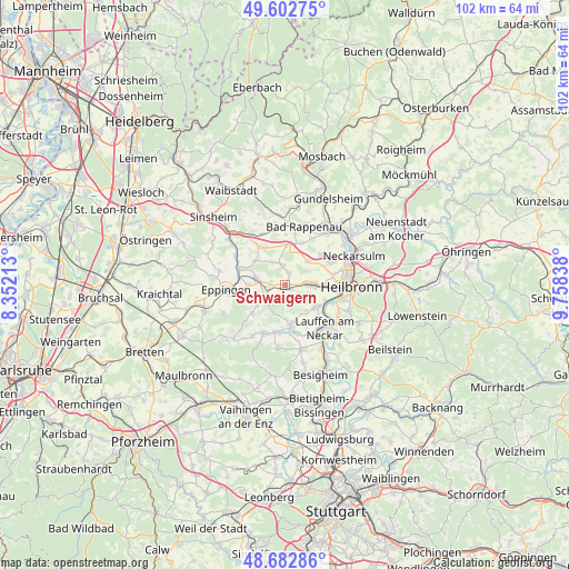
Schwaigern GPS coordinates[2]
49° 8' 41.784" North, 9° 3' 18.9" East
| Map corner | latitude | longitude |
|---|---|---|
| Upper-left | 49.60275°, | 8.35213° |
| Center: | 49.14494°, | 9.05525° |
| Lower-right: | 48.68286°, | 9.75838° |
| Map W x H: | 102.3×102.3 km | = 63.6×63.6mi |
| max Lat: | 55.01917° ⇑81.2% North |
| Schwaigern: | 49.14494° |
| min Lat: | ⇓18.8% South 47.40724° |
| min Long | Schwaigern | max Long |
| 5.92978° | 9.05525° | 14.98853° |
| W 35.3%⇐ | ⇒64.7% E |
Elevation
Elevation of Schwaigern is 202 m = 663 ft, and this is 47.1 m = 155 ft below average elevation for this country.
| Max E: |
1256 m = 4121 ft | 53.2% |
| Avg. | 249.1 m = 817 ft | |
| Schwaigern | 202 m = 663 ft | |
Min E: |
-5 m = -16 ft | 46.8% |
See also: Germany elevation on elevation.city.
Geographical zone
Schwaigern is located in North temperate zone (between Tropic of Cancer and the Arctic Circle). Distance of this North polar circle is 1936.8 km =1203.5 mi to North.| Distance of | km | miles | from Schwaigern |
|---|---|---|---|
| North Pole | 4542.7 | 2822.7 | to North |
| Arctic Circle | 1936.8 | 1203.5 | to North |
| Tropic Cancer | 2858.5 | 1776.2 | to South |
| Equator | 5464.4 | 3395.4 | to South |


Nearby cities:
15 places around Schwaigern: (largest is in red/bold)
• Bad Rappenau
10.9 km =6.8 mi,  18°
18°
• Bad Wimpfen
12 km =7.5 mi,  37°
37°
• Brackenheim
7.5 km =4.7 mi,  174°
174°
• Cleebronn
11.2 km =7 mi,  186°
186°
• Eppingen
10.4 km =6.5 mi,  264°
264°
• Gemmingen
5.5 km =3.4 mi,  283°
283°
• Güglingen
9.6 km =6 mi,  204°
204°
• Heilbronn
12 km =7.5 mi,  92°
92°
• Ittlingen
10.4 km =6.5 mi,  299°
299°
• Kirchardt
8.1 km =5 mi,  325°
325°
• Lauffen am Neckar
10.3 km =6.4 mi,  140°
140°
• Leingarten
4.5 km =2.8 mi, 87°
• Massenbachhausen
3.8 km =2.4 mi,  346°
346°
• Nordheim
6.6 km =4.1 mi,  127°
127°
• Pfaffenhofen
10.6 km =6.6 mi,  212°
212°
Sources, notices
• [Note1] Compared only with cities in Germany existing in our database
• [Src1] Map data: © OpenStreetMap contributors (CC-BY-SA)
• [Src2] Other city data from geonames.org with taken over terms of usage.
• [Src3] Geographical zone / Annual Mean Temperature by Robert A. Rohde @ Wikipedia
