Schülp geodata
Schülp (Schleswig-Holstein) is a seat of a fourth-order administrative division; located in Germany in Europe/Berlin (GMT+2) time zone. With population of 483 people, there are 9442 cities with bigger population in this country. Compared to other cities in Germany, 95.7% of cities are located further ↓South; 66.3% of cities are located further →East and 98.6% of cities have higher elevation than Schülp. Note1


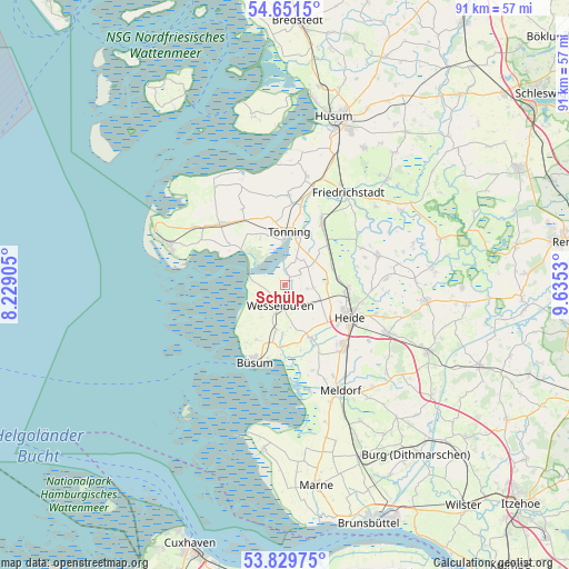
Schülp GPS coordinates[2]
54° 14' 33.612" North, 8° 55' 55.848" East
| Map corner | latitude | longitude |
|---|---|---|
| Upper-left | 54.6515°, | 8.22905° |
| Center: | 54.24267°, | 8.93218° |
| Lower-right: | 53.82975°, | 9.6353° |
| Map W x H: | 91.4×91.4 km | = 56.8×56.8mi |
| max Lat: | 55.01917° ⇑4.3% North |
| Schülp: | 54.24267° |
| min Lat: | ⇓95.7% South 47.40724° |
| min Long | Schülp | max Long |
| 5.92978° | 8.93218° | 14.98853° |
| W 33.7%⇐ | ⇒66.3% E |
Elevation
Elevation of Schülp is 1 m = 3 ft, and this is 248.1 m = 814 ft below average elevation for this country.
| Max E: |
1256 m = 4121 ft | 98.6% |
| Avg. | 249.1 m = 817 ft | |
| Schülp | 1 m = 3 ft | |
Min E: |
-5 m = -16 ft | 1.4% |
See also: Germany elevation on elevation.city.
Geographical zone
Schülp is located in North temperate zone (between Tropic of Cancer and the Arctic Circle). Distance of this North polar circle is 1370 km =851.3 mi to North.| Distance of | km | miles | from Schülp |
|---|---|---|---|
| North Pole | 3975.8 | 2470.4 | to North |
| Arctic Circle | 1370 | 851.3 | to North |
| Tropic Cancer | 3425.3 | 2128.4 | to South |
| Equator | 6031.2 | 3747.6 | to South |


Nearby cities:
15 places around Schülp: (largest is in red/bold)
• Groven
7.2 km =4.5 mi,  27°
27°
• Hellschen-Heringsand-Unterschaar
7.1 km =4.4 mi,  228°
228°
• Hemme
7.1 km =4.4 mi,  50°
50°
• Hillgroven
4.3 km =2.7 mi, 227°
• Karolinenkoog
5 km =3.1 mi, 26°
• Neuenkirchen
3.9 km =2.4 mi,  100°
100°
• Norddeich
3.6 km =2.2 mi,  215°
215°
• Norderwöhrden
7.3 km =4.5 mi,  130°
130°
• Oesterwurth
4.4 km =2.7 mi, 131°
• Rehm-Flehde-Bargen
7.1 km =4.4 mi, 50°
• Reinsbüttel
7.2 km =4.5 mi,  190°
190°
• Strübbel
3.5 km =2.2 mi,  40°
40°
• Süderdeich
4.9 km =3 mi, 191°
• Wesselburen
3.4 km =2.1 mi, 188°
• Wesselburenerkoog
3.3 km =2.1 mi,  284°
284°
Sources, notices
• [Note1] Compared only with cities in Germany existing in our database
• [Src1] Map data: © OpenStreetMap contributors (CC-BY-SA)
• [Src2] Other city data from geonames.org with taken over terms of usage.
• [Src3] Geographical zone / Annual Mean Temperature by Robert A. Rohde @ Wikipedia
