Norderwöhrden geodata
Norderwöhrden (Schleswig-Holstein) is a seat of a fourth-order administrative division; located in Germany in Europe/Berlin (GMT+2) time zone. With population of 286 people, there are 10108 cities with bigger population in this country. Compared to other cities in Germany, 95.1% of cities are located further ↓South; 65.2% of cities are located further →East and 99.5% of cities have higher elevation than Norderwöhrden. Note1
Administrative division(s):
- Level 1: Schleswig-Holstein
- Level 3: Kreis Dithmarschen
- Level 4: Norderwöhrden


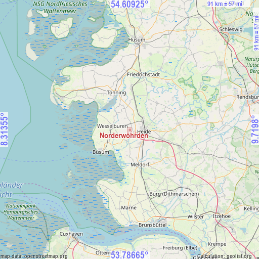
Norderwöhrden GPS coordinates[2]
54° 12' 0" North, 9° 1' 0.012" East
| Map corner | latitude | longitude |
|---|---|---|
| Upper-left | 54.60925°, | 8.31355° |
| Center: | 54.2°, | 9.01667° |
| Lower-right: | 53.78665°, | 9.7198° |
| Map W x H: | 91.5×91.5 km | = 56.9×56.9mi |
| max Lat: | 55.01917° ⇑4.9% North |
| Norderwöhrden: | 54.2° |
| min Lat: | ⇓95.1% South 47.40724° |
| min Long | Norderwöhrden | max Long |
| 5.92978° | 9.01667° | 14.98853° |
| W 34.8%⇐ | ⇒65.2% E |
Elevation
Elevation of Norderwöhrden is -1 m = -3 ft, and this is 250.1 m = 821 ft below average elevation for this country.
| Max E: |
1256 m = 4121 ft | 99.5% |
| Avg. | 249.1 m = 817 ft | |
| Norderwöhrden | -1 m = -3 ft | |
Min E: |
-5 m = -16 ft | 0.5% |
See also: Germany elevation on elevation.city.
Geographical zone
Norderwöhrden is located in North temperate zone (between Tropic of Cancer and the Arctic Circle). Distance of this North polar circle is 1374.7 km =854.2 mi to North.| Distance of | km | miles | from Norderwöhrden |
|---|---|---|---|
| North Pole | 3980.6 | 2473.4 | to North |
| Arctic Circle | 1374.7 | 854.2 | to North |
| Tropic Cancer | 3420.6 | 2125.5 | to South |
| Equator | 6026.5 | 3744.7 | to South |


Nearby cities:
15 places around Norderwöhrden: (largest is in red/bold)
• Friedrichsgabekoog
7.1 km =4.4 mi,  217°
217°
• Heide
5.4 km =3.4 mi,  95°
95°
• Hemmingstedt
6.4 km =4 mi,  149°
149°
• Lieth
5.7 km =3.5 mi, 149°
• Lohe-Rickelshof
3.8 km =2.4 mi,  110°
110°
• Neuenkirchen
4.4 km =2.7 mi,  338°
338°
• Oesterwurth
2.9 km =1.8 mi,  310°
310°
• Ostrohe
7.3 km =4.5 mi,  75°
75°
• Reinsbüttel
7.2 km =4.5 mi,  250°
250°
• Süderdeich
6.5 km =4 mi,  270°
270°
• Weddingstedt
6.2 km =3.9 mi,  51°
51°
• Wesselburen
6.2 km =3.9 mi,  282°
282°
• Wesselburener Deichhausen
6.6 km =4.1 mi,  235°
235°
• Wesseln
4 km =2.5 mi,  74°
74°
• Wöhrden
3.9 km =2.4 mi,  196°
196°
Sources, notices
• [Note1] Compared only with cities in Germany existing in our database
• [Src1] Map data: © OpenStreetMap contributors (CC-BY-SA)
• [Src2] Other city data from geonames.org with taken over terms of usage.
• [Src3] Geographical zone / Annual Mean Temperature by Robert A. Rohde @ Wikipedia
