Schmölln geodata
Schmölln (Thuringia) is a populated place; located in Germany in Europe/Berlin (GMT+2) time zone. With population of 12,604 people, there are 1287 cities with bigger population in this country. Compared to other cities in Germany, 56% of cities are located further ↓South; 86.4% of cities are located further ←West and 52.1% of cities have higher elevation than Schmölln. Note1


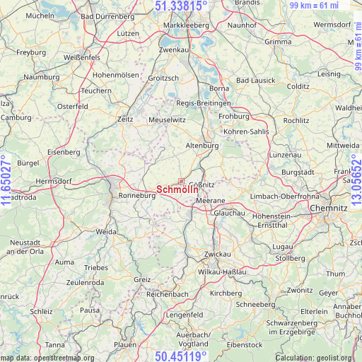
Schmölln GPS coordinates[2]
50° 53' 48.408" North, 12° 21' 12.204" East
| Map corner | latitude | longitude |
|---|---|---|
| Upper-left | 51.33815°, | 11.65027° |
| Center: | 50.89678°, | 12.35339° |
| Lower-right: | 50.45119°, | 13.05652° |
| Map W x H: | 98.6×98.6 km | = 61.3×61.3mi |
| max Lat: | 55.01917° ⇑44% North |
| Schmölln: | 50.89678° |
| min Lat: | ⇓56% South 47.40724° |
| min Long | Schmölln | max Long |
| 5.92978° | 12.35339° | 14.98853° |
| W 86.4%⇐ | ⇒13.6% E |
Elevation
Elevation of Schmölln is 211 m = 692 ft, and this is 38.1 m = 125 ft below average elevation for this country.
| Max E: |
1256 m = 4121 ft | 52.1% |
| Avg. | 249.1 m = 817 ft | |
| Schmölln | 211 m = 692 ft | |
Min E: |
-5 m = -16 ft | 47.9% |
See also: Germany elevation on elevation.city.
Geographical zone
Schmölln is located in North temperate zone (between Tropic of Cancer and the Arctic Circle). Distance of this North polar circle is 1742 km =1082.4 mi to North.| Distance of | km | miles | from Schmölln |
|---|---|---|---|
| North Pole | 4347.9 | 2701.7 | to North |
| Arctic Circle | 1742 | 1082.4 | to North |
| Tropic Cancer | 3053.3 | 1897.2 | to South |
| Equator | 5659.2 | 3516.5 | to South |


Nearby cities:
15 places around Schmölln: (largest is in red/bold)
• Altkirchen
4.1 km =2.5 mi,  356°
356°
• Drogen
3.4 km =2.1 mi,  310°
310°
• Göhren
7.8 km =4.8 mi,  6°
6°
• Göllnitz
6.1 km =3.8 mi,  337°
337°
• Gößnitz
5.6 km =3.5 mi,  98°
98°
• Heyersdorf
5.2 km =3.2 mi,  182°
182°
• Jonaswalde
8 km =5 mi,  207°
207°
• Löbichau
6.3 km =3.9 mi,  267°
267°
• Nöbdenitz
5.9 km =3.7 mi,  235°
235°
• Ponitz
6.5 km =4 mi,  131°
131°
• Posterstein
6.9 km =4.3 mi, 241°
• Saara
6.2 km =3.9 mi,  49°
49°
• Thonhausen
7.5 km =4.7 mi,  200°
200°
• Vollmershain
6.4 km =4 mi,  215°
215°
• Wildenbörten
5.4 km =3.4 mi,  294°
294°
Sources, notices
• [Note1] Compared only with cities in Germany existing in our database
• [Src1] Map data: © OpenStreetMap contributors (CC-BY-SA)
• [Src2] Other city data from geonames.org with taken over terms of usage.
• [Src3] Geographical zone / Annual Mean Temperature by Robert A. Rohde @ Wikipedia
