Schleifreisen geodata
Schleifreisen (Thuringia) is a seat of a fourth-order administrative division; located in Germany in Europe/Berlin (GMT+2) time zone. With population of 479 people, there are 9449 cities with bigger population in this country. Compared to other cities in Germany, 55.7% of cities are located further ↓South; 79% of cities are located further ←West and 68.2% of cities have lower elevation than Schleifreisen. Note1


Schleifreisen GPS coordinates[2]
50° 52' 59.988" North, 11° 49' 0.012" East
| Map corner | latitude | longitude |
|---|---|---|
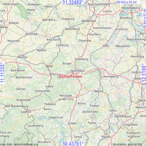
| Upper-left | 51.32482°, | 11.11355° |
| Center: | 50.88333°, | 11.81667° |
| Lower-right: | 50.43761°, | 12.5198° |
| Map W x H: | 98.6×98.6 km | = 61.3×61.3mi |
| max Lat: | 55.01917° ⇑44.3% North |
| Schleifreisen: | 50.88333° |
| min Lat: | ⇓55.7% South 47.40724° |
| min Long | Schleifreisen | max Long |
| 5.92978° | 11.81667° | 14.98853° |
| W 79%⇐ | ⇒21% E |
Elevation
Elevation of Schleifreisen is 344 m = 1129 ft, and this is 94.9 m = 311 ft above average elevation for this country.
| Max E: |
1256 m = 4121 ft | 31.8% |
| Schleifreisen | 344 m 1129 ft | |
| Avg. | 249.1 m = 817 ft | |
Min E: |
-5 m = -16 ft | 68.2% |
See also: Germany elevation on elevation.city.
Geographical zone
Schleifreisen is located in North temperate zone (between Tropic of Cancer and the Arctic Circle). Distance of this North polar circle is 1743.5 km =1083.4 mi to North.| Distance of | km | miles | from Schleifreisen |
|---|---|---|---|
| North Pole | 4349.4 | 2702.6 | to North |
| Arctic Circle | 1743.5 | 1083.4 | to North |
| Tropic Cancer | 3051.8 | 1896.3 | to South |
| Equator | 5657.7 | 3515.5 | to South |


Nearby cities:
15 places around Schleifreisen: (largest is in red/bold)
• Albersdorf
3.8 km =2.4 mi,  305°
305°
• Bad Klosterlausnitz
5.1 km =3.2 mi,  43°
43°
• Bobeck
2.8 km =1.7 mi,  323°
323°
• Bollberg
1.2 km =0.7 mi,  270°
270°
• Hermsdorf
3.1 km =1.9 mi,  60°
60°
• Möckern
5.1 km =3.2 mi,  223°
223°
• Mörsdorf
2 km =1.2 mi, 221°
• Ottendorf
6.2 km =3.9 mi,  174°
174°
• Quirla
4 km =2.5 mi,  242°
242°
• Reichenbach
4.6 km =2.9 mi,  110°
110°
• Ruttersdorf-Lotschen
5.8 km =3.6 mi, 270°
• Scheiditz
5 km =3.1 mi,  299°
299°
• Tissa
6 km =3.7 mi,  231°
231°
• Waldeck
4.4 km =2.7 mi,  327°
327°
• Weißenborn
6.3 km =3.9 mi, 44°
Sources, notices
• [Note1] Compared only with cities in Germany existing in our database
• [Src1] Map data: © OpenStreetMap contributors (CC-BY-SA)
• [Src2] Other city data from geonames.org with taken over terms of usage.
• [Src3] Geographical zone / Annual Mean Temperature by Robert A. Rohde @ Wikipedia
