Quirnbach geodata
Quirnbach (Rheinland-Pfalz) is a populated place; located in Germany in Europe/Berlin (GMT+2) time zone. With population of 527 people, there are 9209 cities with bigger population in this country. Compared to other cities in Germany, 76.1% of cities are located further ↑North; 88.3% of cities are located further →East and 50.7% of cities have lower elevation than Quirnbach. Note1
Administrative division(s):
- Level 1: Rheinland-Pfalz
- Level 3: Landkreis Kusel
- Level 4: Quirnbach/ Pfalz


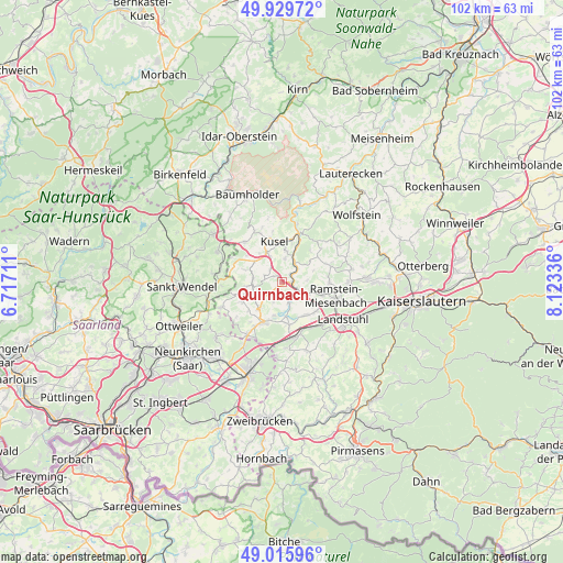
Quirnbach GPS coordinates[2]
49° 28' 29.892" North, 7° 25' 12.828" East
| Map corner | latitude | longitude |
|---|---|---|
| Upper-left | 49.92972°, | 6.71711° |
| Center: | 49.47497°, | 7.42023° |
| Lower-right: | 49.01596°, | 8.12336° |
| Map W x H: | 101.6×101.6 km | = 63.1×63.1mi |
| max Lat: | 55.01917° ⇑76.1% North |
| Quirnbach: | 49.47497° |
| min Lat: | ⇓23.9% South 47.40724° |
| min Long | Quirnbach | max Long |
| 5.92978° | 7.42023° | 14.98853° |
| W 11.7%⇐ | ⇒88.3% E |
Elevation
Elevation of Quirnbach is 231 m = 758 ft, and this is 18.1 m = 59 ft below average elevation for this country.
| Max E: |
1256 m = 4121 ft | 49.3% |
| Avg. | 249.1 m = 817 ft | |
| Quirnbach | 231 m = 758 ft | |
Min E: |
-5 m = -16 ft | 50.7% |
See also: Germany elevation on elevation.city.
Geographical zone
Quirnbach is located in North temperate zone (between Tropic of Cancer and the Arctic Circle). Distance of this North polar circle is 1900.1 km =1180.7 mi to North.| Distance of | km | miles | from Quirnbach |
|---|---|---|---|
| North Pole | 4506 | 2799.9 | to North |
| Arctic Circle | 1900.1 | 1180.7 | to North |
| Tropic Cancer | 2895.2 | 1799 | to South |
| Equator | 5501.1 | 3418.2 | to South |


Nearby cities:
15 places around Quirnbach: (largest is in red/bold)
• Börsborn
4.9 km =3 mi,  197°
197°
• Ehweiler
6 km =3.7 mi,  320°
320°
• Etschberg
4.7 km =2.9 mi,  11°
11°
• Glan-Münchweiler
1.6 km =1 mi,  100°
100°
• Herschweiler-Pettersheim
5.2 km =3.2 mi,  280°
280°
• Hüffler
3.9 km =2.4 mi, 316°
• Matzenbach
4.4 km =2.7 mi,  50°
50°
• Nanzdietschweiler
3.5 km =2.2 mi,  142°
142°
• Neunkirchen am Potzberg
5.3 km =3.3 mi,  58°
58°
• Niedermohr
4 km =2.5 mi,  116°
116°
• Ohmbach
5.8 km =3.6 mi,  241°
241°
• Rehweiler
2 km =1.2 mi, 52°
• Schellweiler
4.8 km =3 mi,  334°
334°
• Theisbergstegen
5.2 km =3.2 mi,  23°
23°
• Wahnwegen
3.3 km =2.1 mi,  288°
288°
Sources, notices
• [Note1] Compared only with cities in Germany existing in our database
• [Src1] Map data: © OpenStreetMap contributors (CC-BY-SA)
• [Src2] Other city data from geonames.org with taken over terms of usage.
• [Src3] Geographical zone / Annual Mean Temperature by Robert A. Rohde @ Wikipedia
