Ritzerow geodata
Ritzerow (Mecklenburg-Vorpommern) is a populated place; located in Germany in Europe/Berlin (GMT+2) time zone. With population of 509 people, there are 9330 cities with bigger population in this country. Compared to other cities in Germany, 87.9% of cities are located further ↓South; 92% of cities are located further ←West and 73.6% of cities have higher elevation than Ritzerow. Note1
Administrative division(s):
- Level 1: Mecklenburg-Vorpommern
- Level 3: Mecklenburgische Seenplatte
- Level 4: Ritzerow


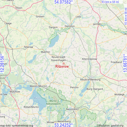
Ritzerow GPS coordinates[2]
53° 39' 40.428" North, 12° 57' 52.848" East
| Map corner | latitude | longitude |
|---|---|---|
| Upper-left | 54.07582°, | 12.26156° |
| Center: | 53.66123°, | 12.96468° |
| Lower-right: | 53.24252°, | 13.66781° |
| Map W x H: | 92.7×92.7 km | = 57.6×57.6mi |
| max Lat: | 55.01917° ⇑12.1% North |
| Ritzerow: | 53.66123° |
| min Lat: | ⇓87.9% South 47.40724° |
| min Long | Ritzerow | max Long |
| 5.92978° | 12.96468° | 14.98853° |
| W 92%⇐ | ⇒8% E |
Elevation
Elevation of Ritzerow is 69 m = 226 ft, and this is 180.1 m = 591 ft below average elevation for this country.
| Max E: |
1256 m = 4121 ft | 73.6% |
| Avg. | 249.1 m = 817 ft | |
| Ritzerow | 69 m = 226 ft | |
Min E: |
-5 m = -16 ft | 26.4% |
See also: Germany elevation on elevation.city.
Geographical zone
Ritzerow is located in North temperate zone (between Tropic of Cancer and the Arctic Circle). Distance of this North polar circle is 1434.6 km =891.4 mi to North.| Distance of | km | miles | from Ritzerow |
|---|---|---|---|
| North Pole | 4040.5 | 2510.6 | to North |
| Arctic Circle | 1434.6 | 891.4 | to North |
| Tropic Cancer | 3360.7 | 2088.2 | to South |
| Equator | 5966.6 | 3707.5 | to South |


Nearby cities:
15 places around Ritzerow: (largest is in red/bold)
• Blankenhof
14.4 km =8.9 mi,  130°
130°
• Breesen
13.7 km =8.5 mi,  104°
104°
• Faulenrost
12 km =7.5 mi,  257°
257°
• Gützkow
11.7 km =7.3 mi,  53°
53°
• Ivenack
5.6 km =3.5 mi,  3°
3°
• Jürgenstorf
3.9 km =2.4 mi,  269°
269°
• Knorrendorf
7.4 km =4.6 mi,  116°
116°
• Kummerow
14.7 km =9.1 mi,  324°
324°
• Mölln
11.2 km =7 mi, 134°
• Reinberg
11.9 km =7.4 mi,  82°
82°
• Rosenow
6 km =3.7 mi, 125°
• Tützpatz
13.7 km =8.5 mi,  59°
59°
• Wackerow
2.1 km =1.3 mi,  32°
32°
• Wildberg
10.5 km =6.5 mi, 95°
• Wolde
8 km =5 mi,  74°
74°
Sources, notices
• [Note1] Compared only with cities in Germany existing in our database
• [Src1] Map data: © OpenStreetMap contributors (CC-BY-SA)
• [Src2] Other city data from geonames.org with taken over terms of usage.
• [Src3] Geographical zone / Annual Mean Temperature by Robert A. Rohde @ Wikipedia
