Rhaunen geodata
Rhaunen (Rheinland-Pfalz) is a seat of a fourth-order administrative division; located in Germany in Europe/Berlin (GMT+2) time zone. With population of 2,287 people, there are 4691 cities with bigger population in this country. Compared to other cities in Germany, 67.5% of cities are located further ↑North; 89.3% of cities are located further →East and 68.2% of cities have lower elevation than Rhaunen. Note1


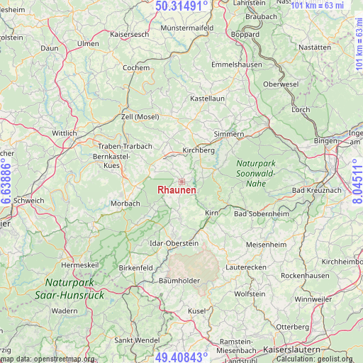
Rhaunen GPS coordinates[2]
49° 51' 49.68" North, 7° 20' 31.128" East
| Map corner | latitude | longitude |
|---|---|---|
| Upper-left | 50.31491°, | 6.63886° |
| Center: | 49.8638°, | 7.34198° |
| Lower-right: | 49.40843°, | 8.04511° |
| Map W x H: | 100.8×100.8 km | = 62.6×62.6mi |
| max Lat: | 55.01917° ⇑67.5% North |
| Rhaunen: | 49.8638° |
| min Lat: | ⇓32.5% South 47.40724° |
| min Long | Rhaunen | max Long |
| 5.92978° | 7.34198° | 14.98853° |
| W 10.7%⇐ | ⇒89.3% E |
Elevation
Elevation of Rhaunen is 344 m = 1129 ft, and this is 94.9 m = 311 ft above average elevation for this country.
| Max E: |
1256 m = 4121 ft | 31.8% |
| Rhaunen | 344 m 1129 ft | |
| Avg. | 249.1 m = 817 ft | |
Min E: |
-5 m = -16 ft | 68.2% |
See also: Germany elevation on elevation.city.
Geographical zone
Rhaunen is located in North temperate zone (between Tropic of Cancer and the Arctic Circle). Distance of this North polar circle is 1856.8 km =1153.8 mi to North.| Distance of | km | miles | from Rhaunen |
|---|---|---|---|
| North Pole | 4462.7 | 2773 | to North |
| Arctic Circle | 1856.8 | 1153.8 | to North |
| Tropic Cancer | 2938.4 | 1825.8 | to South |
| Equator | 5544.3 | 3445.1 | to South |


Nearby cities:
15 places around Rhaunen: (largest is in red/bold)
• Bollenbach
3.4 km =2.1 mi,  170°
170°
• Bruschied
5.4 km =3.4 mi,  129°
129°
• Bundenbach
3.5 km =2.2 mi, 131°
• Gösenroth
2.3 km =1.4 mi,  344°
344°
• Hausen
1.8 km =1.1 mi,  79°
79°
• Laufersweiler
4.5 km =2.8 mi,  323°
323°
• Oberhosenbach
5.3 km =3.3 mi,  186°
186°
• Oberkirn
2.8 km =1.7 mi,  39°
39°
• Schwerbach
4.1 km =2.5 mi,  8°
8°
• Sohrschied
4.1 km =2.5 mi, 8°
• Stipshausen
4.5 km =2.8 mi,  249°
249°
• Sulzbach
3.4 km =2.1 mi, 190°
• Weitersbach
1.8 km =1.1 mi,  279°
279°
• Wickenrodt
5.3 km =3.3 mi, 173°
• Woppenroth
5.4 km =3.4 mi,  86°
86°
Sources, notices
• [Note1] Compared only with cities in Germany existing in our database
• [Src1] Map data: © OpenStreetMap contributors (CC-BY-SA)
• [Src2] Other city data from geonames.org with taken over terms of usage.
• [Src3] Geographical zone / Annual Mean Temperature by Robert A. Rohde @ Wikipedia
