Stipshausen geodata
Stipshausen (Rheinland-Pfalz) is a seat of a fourth-order administrative division; located in Germany in Europe/Berlin (GMT+2) time zone. With population of 970 people, there are 7277 cities with bigger population in this country. Compared to other cities in Germany, 67.8% of cities are located further ↑North; 90.3% of cities are located further →East and 91.5% of cities have lower elevation than Stipshausen. Note1
Administrative division(s):
- Level 1: Rheinland-Pfalz
- Level 3: Landkreis Birkenfeld
- Level 4: Stipshausen


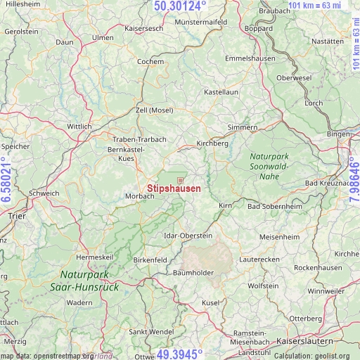
Stipshausen GPS coordinates[2]
49° 51' 0" North, 7° 16' 59.988" East
| Map corner | latitude | longitude |
|---|---|---|
| Upper-left | 50.30124°, | 6.58021° |
| Center: | 49.85°, | 7.28333° |
| Lower-right: | 49.3945°, | 7.98646° |
| Map W x H: | 100.8×100.8 km | = 62.6×62.6mi |
| max Lat: | 55.01917° ⇑67.8% North |
| Stipshausen: | 49.85° |
| min Lat: | ⇓32.2% South 47.40724° |
| min Long | Stipshausen | max Long |
| 5.92978° | 7.28333° | 14.98853° |
| W 9.7%⇐ | ⇒90.3% E |
Elevation
Elevation of Stipshausen is 535 m = 1755 ft, and this is 285.9 m = 938 ft above average elevation for this country.
| Max E: |
1256 m = 4121 ft | 8.5% |
| Stipshausen | 535 m 1755 ft | |
| Avg. | 249.1 m = 817 ft | |
Min E: |
-5 m = -16 ft | 91.5% |
See also: Germany elevation on elevation.city.
Geographical zone
Stipshausen is located in North temperate zone (between Tropic of Cancer and the Arctic Circle). Distance of this North polar circle is 1858.4 km =1154.8 mi to North.| Distance of | km | miles | from Stipshausen |
|---|---|---|---|
| North Pole | 4464.3 | 2774 | to North |
| Arctic Circle | 1858.4 | 1154.8 | to North |
| Tropic Cancer | 2936.9 | 1824.9 | to South |
| Equator | 5542.8 | 3444.1 | to South |


Nearby cities:
15 places around Stipshausen: (largest is in red/bold)
• Asbach
3.7 km =2.3 mi,  180°
180°
• Bollenbach
5.1 km =3.2 mi,  111°
111°
• Gösenroth
5.2 km =3.2 mi,  44°
44°
• Hellertshausen
3.7 km =2.3 mi, 180°
• Horbruch
5.2 km =3.2 mi,  315°
315°
• Hottenbach
3 km =1.9 mi,  159°
159°
• Krummenau
3.9 km =2.4 mi,  342°
342°
• Laufersweiler
5.4 km =3.4 mi,  16°
16°
• Niederweiler
5.6 km =3.5 mi,  0°
0°
• Oberhosenbach
5.2 km =3.2 mi,  135°
135°
• Rhaunen
4.5 km =2.8 mi,  69°
69°
• Schauren
5.8 km =3.6 mi,  214°
214°
• Sulzbach
4 km =2.5 mi,  117°
117°
• Weiden
3.9 km =2.4 mi, 162°
• Weitersbach
3 km =1.9 mi,  52°
52°
Sources, notices
• [Note1] Compared only with cities in Germany existing in our database
• [Src1] Map data: © OpenStreetMap contributors (CC-BY-SA)
• [Src2] Other city data from geonames.org with taken over terms of usage.
• [Src3] Geographical zone / Annual Mean Temperature by Robert A. Rohde @ Wikipedia
