Klingelbach geodata
Klingelbach (Rheinland-Pfalz) is a seat of a fourth-order administrative division; located in Germany in Europe/Berlin (GMT+2) time zone. With population of 762 people, there are 8038 cities with bigger population in this country. Compared to other cities in Germany, 57.2% of cities are located further ↑North; 77.6% of cities are located further →East and 60.9% of cities have lower elevation than Klingelbach. Note1


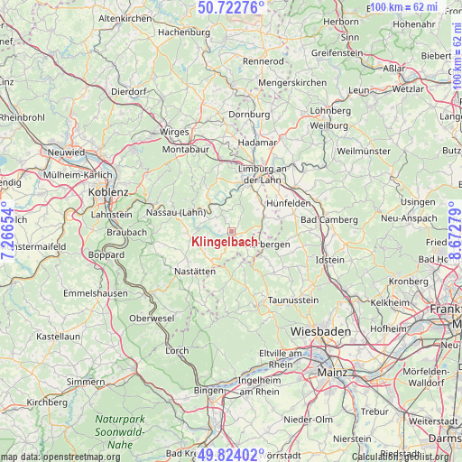
Klingelbach GPS coordinates[2]
50° 16' 31.836" North, 7° 58' 10.776" East
| Map corner | latitude | longitude |
|---|---|---|
| Upper-left | 50.72276°, | 7.26654° |
| Center: | 50.27551°, | 7.96966° |
| Lower-right: | 49.82402°, | 8.67279° |
| Map W x H: | 99.9×99.9 km | = 62.1×62.1mi |
| max Lat: | 55.01917° ⇑57.2% North |
| Klingelbach: | 50.27551° |
| min Lat: | ⇓42.8% South 47.40724° |
| min Long | Klingelbach | max Long |
| 5.92978° | 7.96966° | 14.98853° |
| W 22.4%⇐ | ⇒77.6% E |
Elevation
Elevation of Klingelbach is 295 m = 968 ft, and this is 45.9 m = 151 ft above average elevation for this country.
| Max E: |
1256 m = 4121 ft | 39.1% |
| Klingelbach | 295 m 968 ft | |
| Avg. | 249.1 m = 817 ft | |
Min E: |
-5 m = -16 ft | 60.9% |
See also: Germany elevation on elevation.city.
Geographical zone
Klingelbach is located in North temperate zone (between Tropic of Cancer and the Arctic Circle). Distance of this North polar circle is 1811.1 km =1125.4 mi to North.| Distance of | km | miles | from Klingelbach |
|---|---|---|---|
| North Pole | 4416.9 | 2744.5 | to North |
| Arctic Circle | 1811.1 | 1125.4 | to North |
| Tropic Cancer | 2984.2 | 1854.3 | to South |
| Equator | 5590.1 | 3473.5 | to South |


Nearby cities:
15 places around Klingelbach: (largest is in red/bold)
• Allendorf
2.2 km =1.4 mi,  112°
112°
• Berghausen
3.2 km =2 mi,  124°
124°
• Berndroth
4.3 km =2.7 mi,  180°
180°
• Biebrich
3.5 km =2.2 mi,  336°
336°
• Dörsdorf
4.3 km =2.7 mi,  138°
138°
• Ebertshausen
1.3 km =0.8 mi,  48°
48°
• Ergeshausen
2 km =1.2 mi,  258°
258°
• Herold
2.7 km =1.7 mi,  274°
274°
• Katzenelnbogen
0.9 km =0.6 mi,  164°
164°
• Kördorf
3.7 km =2.3 mi,  290°
290°
• Mittelfischbach
2.5 km =1.6 mi,  194°
194°
• Mudershausen
4.6 km =2.9 mi,  79°
79°
• Oberfischbach
3.1 km =1.9 mi,  199°
199°
• Schönborn
3.5 km =2.2 mi,  29°
29°
• Wasenbach
4.6 km =2.9 mi,  357°
357°
Sources, notices
• [Note1] Compared only with cities in Germany existing in our database
• [Src1] Map data: © OpenStreetMap contributors (CC-BY-SA)
• [Src2] Other city data from geonames.org with taken over terms of usage.
• [Src3] Geographical zone / Annual Mean Temperature by Robert A. Rohde @ Wikipedia
