Raunheim geodata
Raunheim (Hesse) is a populated place; located in Germany in Europe/Berlin (GMT+2) time zone. With population of 13,622 people, there are 1178 cities with bigger population in this country. Compared to other cities in Germany, 63.5% of cities are located further ↑North; 71.5% of cities are located further →East and 70% of cities have higher elevation than Raunheim. Note1
Administrative division(s):
- Level 1: Hesse
- Level 2: Regierungsbezirk Darmstadt
- Level 3: Landkreis Groß-Gerau
- Level 4: Raunheim


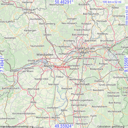
Raunheim GPS coordinates[2]
50° 0' 47.52" North, 8° 27' 9.108" East
| Map corner | latitude | longitude |
|---|---|---|
| Upper-left | 50.46291°, | 7.74941° |
| Center: | 50.0132°, | 8.45253° |
| Lower-right: | 49.55924°, | 9.15566° |
| Map W x H: | 100.5×100.5 km | = 62.4×62.4mi |
| max Lat: | 55.01917° ⇑63.5% North |
| Raunheim: | 50.0132° |
| min Lat: | ⇓36.5% South 47.40724° |
| min Long | Raunheim | max Long |
| 5.92978° | 8.45253° | 14.98853° |
| W 28.5%⇐ | ⇒71.5% E |
Elevation
Elevation of Raunheim is 91 m = 299 ft, and this is 158.1 m = 519 ft below average elevation for this country.
| Max E: |
1256 m = 4121 ft | 70% |
| Avg. | 249.1 m = 817 ft | |
| Raunheim | 91 m = 299 ft | |
Min E: |
-5 m = -16 ft | 30% |
See also: Germany elevation on elevation.city.
Geographical zone
Raunheim is located in North temperate zone (between Tropic of Cancer and the Arctic Circle). Distance of this North polar circle is 1840.2 km =1143.4 mi to North.| Distance of | km | miles | from Raunheim |
|---|---|---|---|
| North Pole | 4446.1 | 2762.7 | to North |
| Arctic Circle | 1840.2 | 1143.4 | to North |
| Tropic Cancer | 2955 | 1836.2 | to South |
| Equator | 5560.9 | 3455.4 | to South |


Nearby cities:
15 places around Raunheim: (largest is in red/bold)
• Bischofsheim
6.5 km =4 mi,  250°
250°
• Bodenheim
12.8 km =8 mi,  227°
227°
• Flörsheim
1.8 km =1.1 mi,  269°
269°
• Ginsheim-Gustavsburg
9 km =5.6 mi,  238°
238°
• Groß-Gerau
10.4 km =6.5 mi,  168°
168°
• Hattersheim
7.4 km =4.6 mi,  12°
12°
• Hochheim am Main
7.2 km =4.5 mi, 271°
• Hofheim am Taunus
8.6 km =5.3 mi,  358°
358°
• Kelsterbach
7.7 km =4.8 mi,  45°
45°
• Kriftel
8 km =5 mi, 8°
• Liederbach
12.5 km =7.8 mi, 13°
• Mörfelden-Walldorf
9.6 km =6 mi,  102°
102°
• Nauheim
7 km =4.3 mi, 173°
• Rüsselsheim
3.4 km =2.1 mi,  219°
219°
• Trebur
10.2 km =6.3 mi,  198°
198°
Sources, notices
• [Note1] Compared only with cities in Germany existing in our database
• [Src1] Map data: © OpenStreetMap contributors (CC-BY-SA)
• [Src2] Other city data from geonames.org with taken over terms of usage.
• [Src3] Geographical zone / Annual Mean Temperature by Robert A. Rohde @ Wikipedia
