Petersberg geodata
Petersberg (Saxony-Anhalt) is a seat of a fourth-order administrative division; located in Germany in Europe/Berlin (GMT+2) time zone. With population of 684 people, there are 8393 cities with bigger population in this country. Compared to other cities in Germany, 67.6% of cities are located further ↓South; 81.2% of cities are located further ←West and 53.2% of cities have lower elevation than Petersberg. Note1


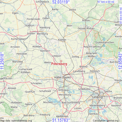
Petersberg GPS coordinates[2]
51° 35' 47.436" North, 11° 57' 11.88" East
| Map corner | latitude | longitude |
|---|---|---|
| Upper-left | 52.03119°, | 11.25018° |
| Center: | 51.59651°, | 11.9533° |
| Lower-right: | 51.15763°, | 12.65643° |
| Map W x H: | 97.1×97.1 km | = 60.3×60.3mi |
| max Lat: | 55.01917° ⇑32.4% North |
| Petersberg: | 51.59651° |
| min Lat: | ⇓67.6% South 47.40724° |
| min Long | Petersberg | max Long |
| 5.92978° | 11.9533° | 14.98853° |
| W 81.2%⇐ | ⇒18.8% E |
Elevation
Elevation of Petersberg is 248 m = 814 ft, and this is 1.1 m = 4 ft below average elevation for this country.
| Max E: |
1256 m = 4121 ft | 46.8% |
| Avg. | 249.1 m = 817 ft | |
| Petersberg | 248 m = 814 ft | |
Min E: |
-5 m = -16 ft | 53.2% |
See also: Germany elevation on elevation.city.
Geographical zone
Petersberg is located in North temperate zone (between Tropic of Cancer and the Arctic Circle). Distance of this North polar circle is 1664.2 km =1034.1 mi to North.| Distance of | km | miles | from Petersberg |
|---|---|---|---|
| North Pole | 4270.1 | 2653.3 | to North |
| Arctic Circle | 1664.2 | 1034.1 | to North |
| Tropic Cancer | 3131.1 | 1945.6 | to South |
| Equator | 5737 | 3564.8 | to South |


Nearby cities:
15 places around Petersberg: (largest is in red/bold)
• Brachstedt
7.3 km =4.5 mi,  112°
112°
• Gutenberg
5.6 km =3.5 mi,  166°
166°
• Krosigk
2 km =1.2 mi,  317°
317°
• Löbejün
5.6 km =3.5 mi, 320°
• Morl
5.3 km =3.3 mi,  204°
204°
• Nauendorf
4.7 km =2.9 mi,  277°
277°
• Neutz-Lettewitz
7.9 km =4.9 mi, 277°
• Oppin
7.4 km =4.6 mi,  132°
132°
• Plötz
4.6 km =2.9 mi,  356°
356°
• Schortewitz
7.9 km =4.9 mi,  38°
38°
• Sennewitz
5.9 km =3.7 mi,  180°
180°
• Stumsdorf
7.9 km =4.9 mi,  73°
73°
• Teicha
4.2 km =2.6 mi, 178°
• Trebitz
2.6 km =1.6 mi,  243°
243°
• Wallwitz
2.5 km =1.6 mi,  223°
223°
Sources, notices
• [Note1] Compared only with cities in Germany existing in our database
• [Src1] Map data: © OpenStreetMap contributors (CC-BY-SA)
• [Src2] Other city data from geonames.org with taken over terms of usage.
• [Src3] Geographical zone / Annual Mean Temperature by Robert A. Rohde @ Wikipedia
