Ottenhofen geodata
Ottenhofen (Baden-Württemberg) is a populated place; located in Germany in Europe/Berlin (GMT+2) time zone. With population of 3,311 people, there are 3746 cities with bigger population in this country. Compared to other cities in Germany, 86% of cities are located further ↑North; 74.9% of cities are located further →East and 63.9% of cities have higher elevation than Ottenhofen. Note1
Administrative division(s):
- Level 1: Baden-Württemberg
- Level 2: Karlsruhe Region
- Level 3: Landkreis Rastatt
- Level 4: Bühl


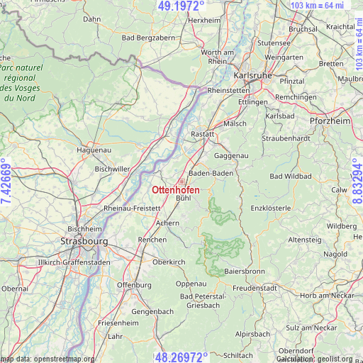
Ottenhofen GPS coordinates[2]
48° 44' 8.16" North, 8° 7' 47.316" East
| Map corner | latitude | longitude |
|---|---|---|
| Upper-left | 49.1972°, | 7.42669° |
| Center: | 48.7356°, | 8.12981° |
| Lower-right: | 48.26972°, | 8.83294° |
| Map W x H: | 103.1×103.1 km | = 64.1×64.1mi |
| max Lat: | 55.01917° ⇑86% North |
| Ottenhofen: | 48.7356° |
| min Lat: | ⇓14% South 47.40724° |
| min Long | Ottenhofen | max Long |
| 5.92978° | 8.12981° | 14.98853° |
| W 25.1%⇐ | ⇒74.9% E |
Elevation
Elevation of Ottenhofen is 127 m = 417 ft, and this is 122.1 m = 401 ft below average elevation for this country.
| Max E: |
1256 m = 4121 ft | 63.9% |
| Avg. | 249.1 m = 817 ft | |
| Ottenhofen | 127 m = 417 ft | |
Min E: |
-5 m = -16 ft | 36.1% |
See also: Germany elevation on elevation.city.
Geographical zone
Ottenhofen is located in North temperate zone (between Tropic of Cancer and the Arctic Circle). Distance of this North polar circle is 1982.3 km =1231.7 mi to North.| Distance of | km | miles | from Ottenhofen |
|---|---|---|---|
| North Pole | 4588.2 | 2851 | to North |
| Arctic Circle | 1982.3 | 1231.7 | to North |
| Tropic Cancer | 2813 | 1747.9 | to South |
| Equator | 5418.9 | 3367.1 | to South |


Nearby cities:
15 places around Ottenhofen: (largest is in red/bold)
• Achern
12.3 km =7.6 mi,  198°
198°
• Baden-Baden
8.5 km =5.3 mi,  70°
70°
• Bühl
4.3 km =2.7 mi,  174°
174°
• Bühlertal
7 km =4.3 mi,  142°
142°
• Greffern
9.3 km =5.8 mi,  281°
281°
• Hügelsheim
7.2 km =4.5 mi,  352°
352°
• Iffezheim
9.6 km =6 mi,  5°
5°
• Lauf
9.5 km =5.9 mi,  178°
178°
• Lichtenau
9.2 km =5.7 mi,  263°
263°
• Ottersweier
7.4 km =4.6 mi,  189°
189°
• Rheinmünster
9.1 km =5.7 mi, 281°
• Sasbach
11 km =6.8 mi, 193°
• Schwarzach
6.9 km =4.3 mi, 280°
• Sinzheim
4.4 km =2.7 mi,  38°
38°
• Zell
6.9 km =4.3 mi,  225°
225°
Sources, notices
• [Note1] Compared only with cities in Germany existing in our database
• [Src1] Map data: © OpenStreetMap contributors (CC-BY-SA)
• [Src2] Other city data from geonames.org with taken over terms of usage.
• [Src3] Geographical zone / Annual Mean Temperature by Robert A. Rohde @ Wikipedia
