Rheinmünster geodata
Rheinmünster (Baden-Württemberg) is a seat of a fourth-order administrative division; located in Germany in Europe/Berlin (GMT+2) time zone. In our database, there are 11009 cities with bigger population. Compared to other cities in Germany, 85.9% of cities are located further ↑North; 76.9% of cities are located further →East and 65% of cities have higher elevation than Rheinmünster. Note1
Administrative division(s):
- Level 1: Baden-Württemberg
- Level 2: Karlsruhe Region
- Level 3: Landkreis Rastatt
- Level 4: Rheinmünster


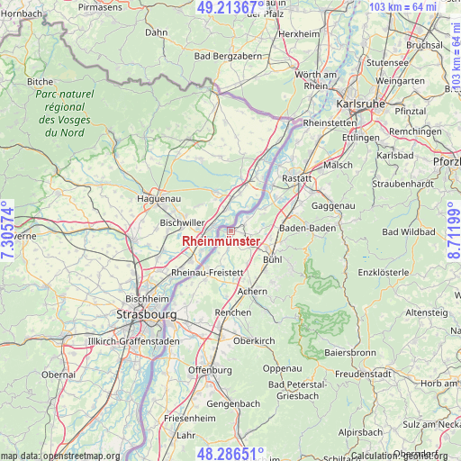
Rheinmünster GPS coordinates[2]
48° 45' 8.028" North, 8° 0' 31.896" East
| Map corner | latitude | longitude |
|---|---|---|
| Upper-left | 49.21367°, | 7.30574° |
| Center: | 48.75223°, | 8.00886° |
| Lower-right: | 48.28651°, | 8.71199° |
| Map W x H: | 103.1×103.1 km | = 64.1×64.1mi |
| max Lat: | 55.01917° ⇑85.9% North |
| Rheinmünster: | 48.75223° |
| min Lat: | ⇓14.1% South 47.40724° |
| min Long | Rheinmünster | max Long |
| 5.92978° | 8.00886° | 14.98853° |
| W 23.1%⇐ | ⇒76.9% E |
Elevation
Elevation of Rheinmünster is 120 m = 394 ft, and this is 129.1 m = 424 ft below average elevation for this country.
| Max E: |
1256 m = 4121 ft | 65% |
| Avg. | 249.1 m = 817 ft | |
| Rheinmünster | 120 m = 394 ft | |
Min E: |
-5 m = -16 ft | 35% |
See also: Germany elevation on elevation.city.
Geographical zone
Rheinmünster is located in North temperate zone (between Tropic of Cancer and the Arctic Circle). Distance of this North polar circle is 1980.4 km =1230.6 mi to North.| Distance of | km | miles | from Rheinmünster |
|---|---|---|---|
| North Pole | 4586.3 | 2849.8 | to North |
| Arctic Circle | 1980.4 | 1230.6 | to North |
| Tropic Cancer | 2814.8 | 1749 | to South |
| Equator | 5420.7 | 3368.3 | to South |


Nearby cities:
15 places around Rheinmünster: (largest is in red/bold)
• Achern
14.3 km =8.9 mi,  159°
159°
• Bühl
11.1 km =6.9 mi,  123°
123°
• Bühlertal
15.1 km =9.4 mi, 119°
• Greffern
0.3 km =0.2 mi,  265°
265°
• Hügelsheim
9.5 km =5.9 mi,  56°
56°
• Iffezheim
12.5 km =7.8 mi,  51°
51°
• Lauf
14.6 km =9.1 mi,  141°
141°
• Lichtenau
2.9 km =1.8 mi,  185°
185°
• Ottenhofen
9.1 km =5.7 mi,  101°
101°
• Ottersweier
11.9 km =7.4 mi, 139°
• Rheinau
11 km =6.8 mi,  208°
208°
• Sasbach
14 km =8.7 mi,  153°
153°
• Schwarzach
2.2 km =1.4 mi, 104°
• Sinzheim
11.7 km =7.3 mi,  82°
82°
• Zell
7.8 km =4.8 mi, 149°
Sources, notices
• [Note1] Compared only with cities in Germany existing in our database
• [Src1] Map data: © OpenStreetMap contributors (CC-BY-SA)
• [Src2] Other city data from geonames.org with taken over terms of usage.
• [Src3] Geographical zone / Annual Mean Temperature by Robert A. Rohde @ Wikipedia
