Oldenburg in Holstein geodata
Oldenburg in Holstein (Schleswig-Holstein) is a populated place; located in Germany in Europe/Berlin (GMT+2) time zone. With population of 9,940 people, there are 1642 cities with bigger population in this country. Compared to other cities in Germany, 96.2% of cities are located further ↓South; 65.5% of cities are located further ←West and 94.8% of cities have higher elevation than Oldenburg in Holstein. Note1
Administrative division(s):
- Level 1: Schleswig-Holstein
- Level 3: Kreis Ostholstein
- Level 4: Oldenburg in Holstein


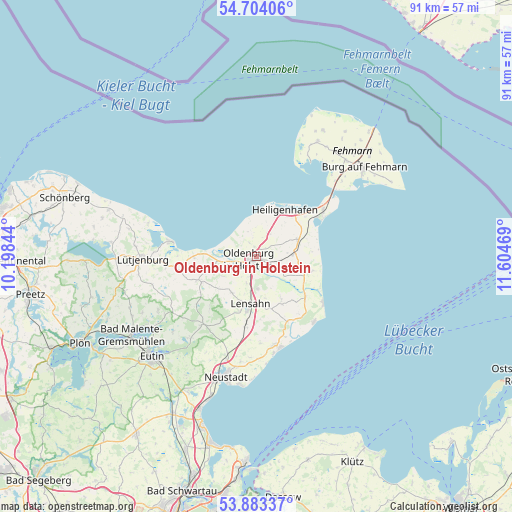
Oldenburg in Holstein GPS coordinates[2]
54° 17' 44.736" North, 10° 54' 5.616" East
| Map corner | latitude | longitude |
|---|---|---|
| Upper-left | 54.70406°, | 10.19844° |
| Center: | 54.29576°, | 10.90156° |
| Lower-right: | 53.88337°, | 11.60469° |
| Map W x H: | 91.3×91.3 km | = 56.7×56.7mi |
| max Lat: | 55.01917° ⇑3.8% North |
| Oldenburg in Holstein: | 54.29576° |
| min Lat: | ⇓96.2% South 47.40724° |
| min Long | Oldenburg in Ho | max Long |
| 5.92978° | 10.90156° | 14.98853° |
| W 65.5%⇐ | ⇒34.5% E |
Elevation
Elevation of Oldenburg in Holstein is 9 m = 30 ft, and this is 240.1 m = 788 ft below average elevation for this country.
| Max E: |
1256 m = 4121 ft | 94.8% |
| Avg. | 249.1 m = 817 ft | |
| Oldenburg in Holstein | 9 m = 30 ft | |
Min E: |
-5 m = -16 ft | 5.2% |
See also: Germany elevation on elevation.city.
Geographical zone
Oldenburg in Holstein is located in North temperate zone (between Tropic of Cancer and the Arctic Circle). Distance of this North polar circle is 1364.1 km =847.6 mi to North.| Distance of | km | miles | from Oldenburg in Holstein |
|---|---|---|---|
| North Pole | 3969.9 | 2466.8 | to North |
| Arctic Circle | 1364.1 | 847.6 | to North |
| Tropic Cancer | 3431.2 | 2132 | to South |
| Equator | 6037.1 | 3751.3 | to South |


Nearby cities:
15 places around Oldenburg in Holstein: (largest is in red/bold)
• Beschendorf
12.7 km =7.9 mi,  190°
190°
• Dahme
14.7 km =9.1 mi,  126°
126°
• Damlos
5.1 km =3.2 mi,  181°
181°
• Goel
2.9 km =1.8 mi,  118°
118°
• Gremersdorf
4.7 km =2.9 mi,  26°
26°
• Grube
11 km =6.8 mi, 129°
• Harmsdorf
7.6 km =4.7 mi,  215°
215°
• Heiligenhafen
9.7 km =6 mi, 31°
• Heringsdorf
6.8 km =4.2 mi,  85°
85°
• Kabelhorst
8.8 km =5.5 mi,  173°
173°
• Lensahn
8.9 km =5.5 mi, 187°
• Manhagen
10.7 km =6.6 mi, 174°
• Neukirchen
8 km =5 mi,  66°
66°
• Riepsdorf
9 km =5.6 mi,  149°
149°
• Wangels
9.3 km =5.8 mi,  249°
249°
In other languages:
- In France: Oldenbourg en Holstein
- In Russian: Ольденбург-ин-Хольштайн
- In Chinese: 荷尔斯泰因地区奥尔登堡
Sources, notices
• [Note1] Compared only with cities in Germany existing in our database
• [Src1] Map data: © OpenStreetMap contributors (CC-BY-SA)
• [Src2] Other city data from geonames.org with taken over terms of usage.
• [Src3] Geographical zone / Annual Mean Temperature by Robert A. Rohde @ Wikipedia
