Ober-Mörlen geodata
Ober-Mörlen (Hesse) is a seat of a fourth-order administrative division; located in Germany in Europe/Berlin (GMT+2) time zone. With population of 5,967 people, there are 2469 cities with bigger population in this country. Compared to other cities in Germany, 55.2% of cities are located further ↑North; 69.2% of cities are located further →East and 57% of cities have higher elevation than Ober-Mörlen. Note1
Administrative division(s):
- Level 1: Hesse
- Level 2: Regierungsbezirk Darmstadt
- Level 3: Wetteraukreis
- Level 4: Ober-Mörlen


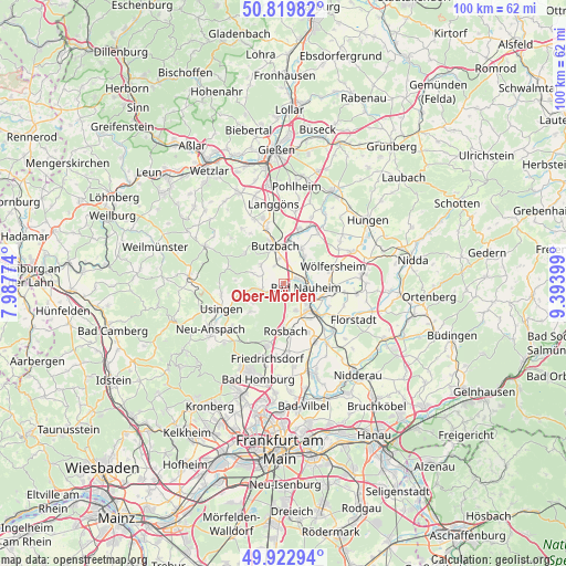
Ober-Mörlen GPS coordinates[2]
50° 22' 24.6" North, 8° 41' 27.132" East
| Map corner | latitude | longitude |
|---|---|---|
| Upper-left | 50.81982°, | 7.98774° |
| Center: | 50.3735°, | 8.69087° |
| Lower-right: | 49.92294°, | 9.39399° |
| Map W x H: | 99.7×99.7 km | = 62×62mi |
| max Lat: | 55.01917° ⇑55.2% North |
| Ober-Mörlen: | 50.3735° |
| min Lat: | ⇓44.8% South 47.40724° |
| min Long | Ober-Mörlen | max Long |
| 5.92978° | 8.69087° | 14.98853° |
| W 30.8%⇐ | ⇒69.2% E |
Elevation
Elevation of Ober-Mörlen is 175 m = 574 ft, and this is 74.1 m = 243 ft below average elevation for this country.
| Max E: |
1256 m = 4121 ft | 57% |
| Avg. | 249.1 m = 817 ft | |
| Ober-Mörlen | 175 m = 574 ft | |
Min E: |
-5 m = -16 ft | 43% |
See also: Germany elevation on elevation.city.
Geographical zone
Ober-Mörlen is located in North temperate zone (between Tropic of Cancer and the Arctic Circle). Distance of this North polar circle is 1800.2 km =1118.6 mi to North.| Distance of | km | miles | from Ober-Mörlen |
|---|---|---|---|
| North Pole | 4406.1 | 2737.8 | to North |
| Arctic Circle | 1800.2 | 1118.6 | to North |
| Tropic Cancer | 2995.1 | 1861.1 | to South |
| Equator | 5601 | 3480.3 | to South |


Nearby cities:
15 places around Ober-Mörlen: (largest is in red/bold)
• Bad Nauheim
3.5 km =2.2 mi,  106°
106°
• Berstadt
13.7 km =8.5 mi,  64°
64°
• Butzbach
6.9 km =4.3 mi,  348°
348°
• Echzell
13.9 km =8.6 mi,  82°
82°
• Friedberg
6.1 km =3.8 mi,  131°
131°
• Melbach
8.4 km =5.2 mi,  85°
85°
• Münzenberg
10.7 km =6.6 mi,  33°
33°
• Reichelsheim
13.2 km =8.2 mi,  98°
98°
• Rockenberg
7.1 km =4.4 mi, 27°
• Rosbach vor der Höhe
7.8 km =4.8 mi,  180°
180°
• Södel
8.4 km =5.2 mi,  74°
74°
• Usingen
11.7 km =7.3 mi,  248°
248°
• Wehrheim
12 km =7.5 mi,  227°
227°
• Wohnbach
11.6 km =7.2 mi, 57°
• Wölfersheim
9.4 km =5.8 mi, 71°
Sources, notices
• [Note1] Compared only with cities in Germany existing in our database
• [Src1] Map data: © OpenStreetMap contributors (CC-BY-SA)
• [Src2] Other city data from geonames.org with taken over terms of usage.
• [Src3] Geographical zone / Annual Mean Temperature by Robert A. Rohde @ Wikipedia
