Oberbergkirchen geodata
Oberbergkirchen (Bavaria) is a seat of a fourth-order administrative division; located in Germany in Europe/Berlin (GMT+2) time zone. With population of 1,629 people, there are 5639 cities with bigger population in this country. Compared to other cities in Germany, 91.2% of cities are located further ↑North; 86.8% of cities are located further ←West and 82.7% of cities have lower elevation than Oberbergkirchen. Note1
Administrative division(s):
- Level 1: Bavaria
- Level 2: Upper Bavaria
- Level 3: Landkreis Mühldorf am Inn
- Level 4: Oberbergkirchen


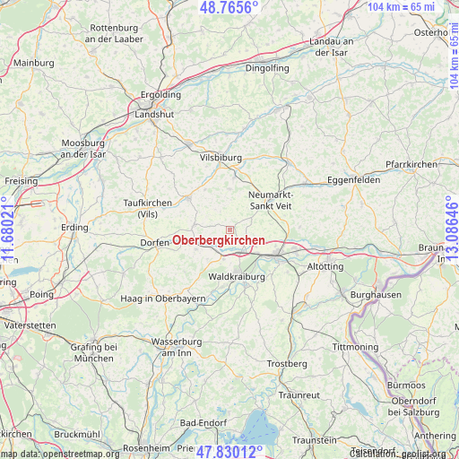
Oberbergkirchen GPS coordinates[2]
48° 18' 0" North, 12° 22' 59.988" East
| Map corner | latitude | longitude |
|---|---|---|
| Upper-left | 48.7656°, | 11.68021° |
| Center: | 48.3°, | 12.38333° |
| Lower-right: | 47.83012°, | 13.08646° |
| Map W x H: | 104×104 km | = 64.6×64.6mi |
| max Lat: | 55.01917° ⇑91.2% North |
| Oberbergkirchen: | 48.3° |
| min Lat: | ⇓8.8% South 47.40724° |
| min Long | Oberbergkirchen | max Long |
| 5.92978° | 12.38333° | 14.98853° |
| W 86.8%⇐ | ⇒13.2% E |
Elevation
Elevation of Oberbergkirchen is 451 m = 1480 ft, and this is 201.9 m = 662 ft above average elevation for this country.
| Max E: |
1256 m = 4121 ft | 17.3% |
| Oberbergkirchen | 451 m 1480 ft | |
| Avg. | 249.1 m = 817 ft | |
Min E: |
-5 m = -16 ft | 82.7% |
See also: Germany elevation on elevation.city.
Geographical zone
Oberbergkirchen is located in North temperate zone (between Tropic of Cancer and the Arctic Circle). Distance of this North polar circle is 2030.7 km =1261.8 mi to North.| Distance of | km | miles | from Oberbergkirchen |
|---|---|---|---|
| North Pole | 4636.6 | 2881 | to North |
| Arctic Circle | 2030.7 | 1261.8 | to North |
| Tropic Cancer | 2764.5 | 1717.8 | to South |
| Equator | 5370.5 | 3337.1 | to South |


Nearby cities:
15 places around Oberbergkirchen: (largest is in red/bold)
• Ampfing
5.6 km =3.5 mi,  155°
155°
• Bodenkirchen
9.3 km =5.8 mi,  0°
0°
• Buchbach
8.2 km =5.1 mi,  279°
279°
• Lohkirchen
5.3 km =3.3 mi,  69°
69°
• Mettenheim
7.2 km =4.5 mi,  121°
121°
• Neufahrn
6.5 km =4 mi,  139°
139°
• Neumarkt-Sankt Veit
11.4 km =7.1 mi,  53°
53°
• Niederbergkirchen
8.8 km =5.5 mi,  77°
77°
• Obertaufkirchen
8.9 km =5.5 mi,  240°
240°
• Rattenkirchen
8.2 km =5.1 mi,  218°
218°
• Schwindegg
9.7 km =6 mi,  250°
250°
• Schönberg
5.2 km =3.2 mi,  44°
44°
• Waldkraiburg
10.2 km =6.3 mi,  173°
173°
• Wurmsham
6.7 km =4.2 mi,  326°
326°
• Zangberg
4.1 km =2.5 mi,  133°
133°
Sources, notices
• [Note1] Compared only with cities in Germany existing in our database
• [Src1] Map data: © OpenStreetMap contributors (CC-BY-SA)
• [Src2] Other city data from geonames.org with taken over terms of usage.
• [Src3] Geographical zone / Annual Mean Temperature by Robert A. Rohde @ Wikipedia
