Lohe-Rickelshof geodata
Lohe-Rickelshof (Schleswig-Holstein) is a seat of a fourth-order administrative division; located in Germany in Europe/Berlin (GMT+2) time zone. With population of 1,985 people, there are 5092 cities with bigger population in this country. Compared to other cities in Germany, 95% of cities are located further ↓South; 64.4% of cities are located further →East and 94.8% of cities have higher elevation than Lohe-Rickelshof. Note1
Administrative division(s):
- Level 1: Schleswig-Holstein
- Level 3: Kreis Dithmarschen
- Level 4: Lohe-Rickelshof


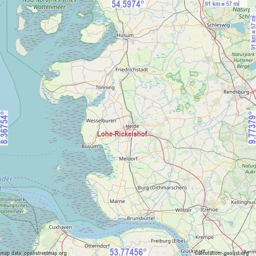
Lohe-Rickelshof GPS coordinates[2]
54° 11' 16.908" North, 9° 4' 14.376" East
| Map corner | latitude | longitude |
|---|---|---|
| Upper-left | 54.5974°, | 8.36754° |
| Center: | 54.18803°, | 9.07066° |
| Lower-right: | 53.77456°, | 9.77379° |
| Map W x H: | 91.5×91.5 km | = 56.9×56.9mi |
| max Lat: | 55.01917° ⇑5% North |
| Lohe-Rickelshof: | 54.18803° |
| min Lat: | ⇓95% South 47.40724° |
| min Long | Lohe-Rickelshof | max Long |
| 5.92978° | 9.07066° | 14.98853° |
| W 35.6%⇐ | ⇒64.4% E |
Elevation
Elevation of Lohe-Rickelshof is 9 m = 30 ft, and this is 240.1 m = 788 ft below average elevation for this country.
| Max E: |
1256 m = 4121 ft | 94.8% |
| Avg. | 249.1 m = 817 ft | |
| Lohe-Rickelshof | 9 m = 30 ft | |
Min E: |
-5 m = -16 ft | 5.2% |
See also: Germany elevation on elevation.city.
Geographical zone
Lohe-Rickelshof is located in North temperate zone (between Tropic of Cancer and the Arctic Circle). Distance of this North polar circle is 1376 km =855 mi to North.| Distance of | km | miles | from Lohe-Rickelshof |
|---|---|---|---|
| North Pole | 3981.9 | 2474.2 | to North |
| Arctic Circle | 1376 | 855 | to North |
| Tropic Cancer | 3419.2 | 2124.6 | to South |
| Equator | 6025.1 | 3743.8 | to South |


Nearby cities:
15 places around Lohe-Rickelshof: (largest is in red/bold)
• Epenwöhrden
8.7 km =5.4 mi,  187°
187°
• Heide
2 km =1.2 mi,  64°
64°
• Hemmingstedt
4.2 km =2.6 mi,  183°
183°
• Lieth
3.6 km =2.2 mi, 190°
• Neuenkirchen
7.5 km =4.7 mi,  316°
316°
• Norderheistedt
8.6 km =5.3 mi,  36°
36°
• Norderwöhrden
3.8 km =2.4 mi,  290°
290°
• Nordhastedt
7.7 km =4.8 mi,  107°
107°
• Oesterwurth
6.5 km =4 mi,  299°
299°
• Ostrohe
4.7 km =2.9 mi,  48°
48°
• Stelle-Wittenwurth
8.8 km =5.5 mi,  351°
351°
• Süderheistedt
7.2 km =4.5 mi, 43°
• Weddingstedt
5.3 km =3.3 mi,  14°
14°
• Wesseln
2.5 km =1.6 mi, 8°
• Wöhrden
5.2 km =3.2 mi,  242°
242°
Sources, notices
• [Note1] Compared only with cities in Germany existing in our database
• [Src1] Map data: © OpenStreetMap contributors (CC-BY-SA)
• [Src2] Other city data from geonames.org with taken over terms of usage.
• [Src3] Geographical zone / Annual Mean Temperature by Robert A. Rohde @ Wikipedia
