Neuhütten geodata
Neuhütten (Rheinland-Pfalz) is a seat of a fourth-order administrative division; located in Germany in Europe/Berlin (GMT+2) time zone. With population of 831 people, there are 7768 cities with bigger population in this country. Compared to other cities in Germany, 72.7% of cities are located further ↑North; 93.2% of cities are located further →East and 92.3% of cities have lower elevation than Neuhütten. Note1
Administrative division(s):
- Level 1: Rheinland-Pfalz
- Level 3: Landkreis Trier-Saarburg
- Level 4: Neuhütten


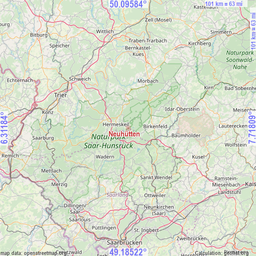
Neuhütten GPS coordinates[2]
49° 38' 33.576" North, 7° 0' 53.892" East
| Map corner | latitude | longitude |
|---|---|---|
| Upper-left | 50.09584°, | 6.31184° |
| Center: | 49.64266°, | 7.01497° |
| Lower-right: | 49.18522°, | 7.71809° |
| Map W x H: | 101.3×101.3 km | = 62.9×62.9mi |
| max Lat: | 55.01917° ⇑72.7% North |
| Neuhütten: | 49.64266° |
| min Lat: | ⇓27.3% South 47.40724° |
| min Long | Neuhütten | max Long |
| 5.92978° | 7.01497° | 14.98853° |
| W 6.8%⇐ | ⇒93.2% E |
Elevation
Elevation of Neuhütten is 546 m = 1791 ft, and this is 296.9 m = 974 ft above average elevation for this country.
| Max E: |
1256 m = 4121 ft | 7.7% |
| Neuhütten | 546 m 1791 ft | |
| Avg. | 249.1 m = 817 ft | |
Min E: |
-5 m = -16 ft | 92.3% |
See also: Germany elevation on elevation.city.
Geographical zone
Neuhütten is located in North temperate zone (between Tropic of Cancer and the Arctic Circle). Distance of this North polar circle is 1881.4 km =1169 mi to North.| Distance of | km | miles | from Neuhütten |
|---|---|---|---|
| North Pole | 4487.3 | 2788.3 | to North |
| Arctic Circle | 1881.4 | 1169 | to North |
| Tropic Cancer | 2913.8 | 1810.6 | to South |
| Equator | 5519.7 | 3429.8 | to South |


Nearby cities:
15 places around Neuhütten: (largest is in red/bold)
• Abentheuer
6.2 km =3.9 mi,  82°
82°
• Achtelsbach
5.7 km =3.5 mi,  109°
109°
• Brücken
7.4 km =4.6 mi,  98°
98°
• Buhlenberg
7.7 km =4.8 mi, 79°
• Börfink
6.7 km =4.2 mi,  47°
47°
• Dambach
8.6 km =5.3 mi, 96°
• Damflos
3.5 km =2.2 mi,  319°
319°
• Dhronecken
8.5 km =5.3 mi,  344°
344°
• Geisfeld
9.5 km =5.9 mi,  330°
330°
• Gusenburg
8.3 km =5.2 mi,  262°
262°
• Hermeskeil
5.3 km =3.3 mi,  285°
285°
• Malborn
8.5 km =5.3 mi, 344°
• Meckenbach
6.8 km =4.2 mi,  115°
115°
• Nonnweiler
5.1 km =3.2 mi,  219°
219°
• Züsch
1.4 km =0.9 mi,  307°
307°
Sources, notices
• [Note1] Compared only with cities in Germany existing in our database
• [Src1] Map data: © OpenStreetMap contributors (CC-BY-SA)
• [Src2] Other city data from geonames.org with taken over terms of usage.
• [Src3] Geographical zone / Annual Mean Temperature by Robert A. Rohde @ Wikipedia
