Riederich geodata
Riederich (Baden-Württemberg) is a seat of a fourth-order administrative division; located in Germany in Europe/Berlin (GMT+2) time zone. With population of 4,395 people, there are 3098 cities with bigger population in this country. Compared to other cities in Germany, 88.3% of cities are located further ↑North; 61.2% of cities are located further →East and 65.4% of cities have lower elevation than Riederich. Note1
Administrative division(s):
- Level 1: Baden-Württemberg
- Level 2: Tübingen Region
- Level 3: Landkreis Reutlingen
- Level 4: Riederich


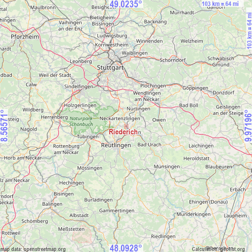
Riederich GPS coordinates[2]
48° 33' 37.044" North, 9° 16' 7.788" East
| Map corner | latitude | longitude |
|---|---|---|
| Upper-left | 49.0235°, | 8.56571° |
| Center: | 48.56029°, | 9.26883° |
| Lower-right: | 48.0928°, | 9.97196° |
| Map W x H: | 103.5×103.5 km | = 64.3×64.3mi |
| max Lat: | 55.01917° ⇑88.3% North |
| Riederich: | 48.56029° |
| min Lat: | ⇓11.7% South 47.40724° |
| min Long | Riederich | max Long |
| 5.92978° | 9.26883° | 14.98853° |
| W 38.8%⇐ | ⇒61.2% E |
Elevation
Elevation of Riederich is 324 m = 1063 ft, and this is 74.9 m = 246 ft above average elevation for this country.
| Max E: |
1256 m = 4121 ft | 34.6% |
| Riederich | 324 m 1063 ft | |
| Avg. | 249.1 m = 817 ft | |
Min E: |
-5 m = -16 ft | 65.4% |
See also: Germany elevation on elevation.city.
Geographical zone
Riederich is located in North temperate zone (between Tropic of Cancer and the Arctic Circle). Distance of this North polar circle is 2001.8 km =1243.9 mi to North.| Distance of | km | miles | from Riederich |
|---|---|---|---|
| North Pole | 4607.7 | 2863.1 | to North |
| Arctic Circle | 2001.8 | 1243.9 | to North |
| Tropic Cancer | 2793.5 | 1735.8 | to South |
| Equator | 5399.4 | 3355 | to South |


Nearby cities:
15 places around Riederich: (largest is in red/bold)
• Altdorf
3.8 km =2.4 mi,  3°
3°
• Altenriet
4.9 km =3 mi,  315°
315°
• Bempflingen
1.3 km =0.8 mi,  358°
358°
• Dettingen an der Erms
6.5 km =4 mi,  120°
120°
• Eningen unter Achalm
8.2 km =5.1 mi,  184°
184°
• Frickenhausen
7.7 km =4.8 mi,  61°
61°
• Großbettlingen
4.4 km =2.7 mi,  40°
40°
• Kohlberg
4.9 km =3 mi,  92°
92°
• Metzingen
2.8 km =1.7 mi,  157°
157°
• Neckartailfingen
5.7 km =3.5 mi, 356°
• Neckartenzlingen
4.1 km =2.5 mi, 322°
• Neuffen
7.9 km =4.9 mi, 94°
• Pliezhausen
4.5 km =2.8 mi,  268°
268°
• Schlaitdorf
6 km =3.7 mi,  325°
325°
• Sickenhausen
7.2 km =4.5 mi,  244°
244°
Sources, notices
• [Note1] Compared only with cities in Germany existing in our database
• [Src1] Map data: © OpenStreetMap contributors (CC-BY-SA)
• [Src2] Other city data from geonames.org with taken over terms of usage.
• [Src3] Geographical zone / Annual Mean Temperature by Robert A. Rohde @ Wikipedia
