Neuendorf geodata
Neuendorf (Schleswig-Holstein) is a populated place; located in Germany in Europe/Berlin (GMT+2) time zone. With population of 899 people, there are 7529 cities with bigger population in this country. Compared to other cities in Germany, 89.2% of cities are located further ↓South; 56.9% of cities are located further →East and 99.1% of cities have higher elevation than Neuendorf. Note1
Administrative division(s):
- Level 1: Schleswig-Holstein
- Level 3: Kreis Steinburg
- Level 4: Neuendorf b. Elmshorn


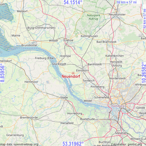
Neuendorf GPS coordinates[2]
53° 44' 15.252" North, 9° 33' 45.684" East
| Map corner | latitude | longitude |
|---|---|---|
| Upper-left | 54.1514°, | 8.85956° |
| Center: | 53.73757°, | 9.56269° |
| Lower-right: | 53.31962°, | 10.26582° |
| Map W x H: | 92.5×92.5 km | = 57.5×57.5mi |
| max Lat: | 55.01917° ⇑10.8% North |
| Neuendorf: | 53.73757° |
| min Lat: | ⇓89.2% South 47.40724° |
| min Long | Neuendorf | max Long |
| 5.92978° | 9.56269° | 14.98853° |
| W 43.1%⇐ | ⇒56.9% E |
Elevation
Elevation of Neuendorf is 0 m = 0 ft, and this is 249.1 m = 817 ft below average elevation for this country.
| Max E: |
1256 m = 4121 ft | 99.1% |
| Avg. | 249.1 m = 817 ft | |
| Neuendorf | 0 m = 0 ft | |
Min E: |
-5 m = -16 ft | 0.9% |
See also: Germany elevation on elevation.city.
Geographical zone
Neuendorf is located in North temperate zone (between Tropic of Cancer and the Arctic Circle). Distance of this North polar circle is 1426.1 km =886.1 mi to North.| Distance of | km | miles | from Neuendorf |
|---|---|---|---|
| North Pole | 4032 | 2505.4 | to North |
| Arctic Circle | 1426.1 | 886.1 | to North |
| Tropic Cancer | 3369.1 | 2093.5 | to South |
| Equator | 5975.1 | 3712.8 | to South |


Nearby cities:
15 places around Neuendorf: (largest is in red/bold)
• Altenmoor
3.2 km =2 mi,  4°
4°
• Elmshorn
6.2 km =3.9 mi,  73°
73°
• Groß Nordende
7.1 km =4.4 mi,  126°
126°
• Heidgraben
8.5 km =5.3 mi,  112°
112°
• Herzhorn
7.3 km =4.5 mi,  314°
314°
• Horst
9.2 km =5.7 mi,  25°
25°
• Kiebitzreihe
6.2 km =3.9 mi, 34°
• Klein Nordende
6.3 km =3.9 mi, 105°
• Kollmar
5.6 km =3.5 mi,  260°
260°
• Neuendeich
7 km =4.3 mi,  149°
149°
• Raa-Besenbek
2.4 km =1.5 mi,  60°
60°
• Seester
3.2 km =2 mi, 133°
• Seestermühe
4.2 km =2.6 mi,  176°
176°
• Sommerland
7.5 km =4.7 mi,  347°
347°
• Uetersen
8.7 km =5.4 mi, 129°
Sources, notices
• [Note1] Compared only with cities in Germany existing in our database
• [Src1] Map data: © OpenStreetMap contributors (CC-BY-SA)
• [Src2] Other city data from geonames.org with taken over terms of usage.
• [Src3] Geographical zone / Annual Mean Temperature by Robert A. Rohde @ Wikipedia
