Neuendeich geodata
Neuendeich (Schleswig-Holstein) is a seat of a fourth-order administrative division; located in Germany in Europe/Berlin (GMT+2) time zone. With population of 537 people, there are 9150 cities with bigger population in this country. Compared to other cities in Germany, 88.3% of cities are located further ↓South; 55.9% of cities are located further →East and 99.5% of cities have higher elevation than Neuendeich. Note1
Administrative division(s):
- Level 1: Schleswig-Holstein
- Level 3: Kreis Pinneberg
- Level 4: Neuendeich


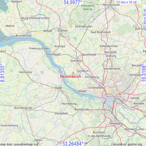
Neuendeich GPS coordinates[2]
53° 40' 59.988" North, 9° 37' 0.012" East
| Map corner | latitude | longitude |
|---|---|---|
| Upper-left | 54.0977°, | 8.91355° |
| Center: | 53.68333°, | 9.61667° |
| Lower-right: | 53.26484°, | 10.3198° |
| Map W x H: | 92.6×92.6 km | = 57.5×57.5mi |
| max Lat: | 55.01917° ⇑11.7% North |
| Neuendeich: | 53.68333° |
| min Lat: | ⇓88.3% South 47.40724° |
| min Long | Neuendeich | max Long |
| 5.92978° | 9.61667° | 14.98853° |
| W 44.1%⇐ | ⇒55.9% E |
Elevation
Elevation of Neuendeich is -1 m = -3 ft, and this is 250.1 m = 821 ft below average elevation for this country.
| Max E: |
1256 m = 4121 ft | 99.5% |
| Avg. | 249.1 m = 817 ft | |
| Neuendeich | -1 m = -3 ft | |
Min E: |
-5 m = -16 ft | 0.5% |
See also: Germany elevation on elevation.city.
Geographical zone
Neuendeich is located in North temperate zone (between Tropic of Cancer and the Arctic Circle). Distance of this North polar circle is 1432.1 km =889.9 mi to North.| Distance of | km | miles | from Neuendeich |
|---|---|---|---|
| North Pole | 4038 | 2509.1 | to North |
| Arctic Circle | 1432.1 | 889.9 | to North |
| Tropic Cancer | 3363.1 | 2089.7 | to South |
| Equator | 5969 | 3709 | to South |


Nearby cities:
15 places around Neuendeich: (largest is in red/bold)
• Elmshorn
8.2 km =5.1 mi,  17°
17°
• Groß Nordende
2.9 km =1.8 mi,  49°
49°
• Haselau
2.4 km =1.5 mi,  174°
174°
• Haseldorf
5.3 km =3.3 mi,  198°
198°
• Heidgraben
5 km =3.1 mi,  57°
57°
• Heist
4.3 km =2.7 mi,  149°
149°
• Holm
8.1 km =5 mi,  156°
156°
• Klein Nordende
5 km =3.1 mi,  29°
29°
• Moorrege
3.8 km =2.4 mi,  119°
119°
• Neuendorf
7 km =4.3 mi,  329°
329°
• Raa-Besenbek
7.4 km =4.6 mi,  348°
348°
• Seester
4 km =2.5 mi,  342°
342°
• Seestermühe
3.8 km =2.4 mi,  299°
299°
• Tornesch
6.8 km =4.2 mi,  74°
74°
• Uetersen
3.2 km =2 mi,  81°
81°
Sources, notices
• [Note1] Compared only with cities in Germany existing in our database
• [Src1] Map data: © OpenStreetMap contributors (CC-BY-SA)
• [Src2] Other city data from geonames.org with taken over terms of usage.
• [Src3] Geographical zone / Annual Mean Temperature by Robert A. Rohde @ Wikipedia
