Mühlacker geodata
Mühlacker (Baden-Württemberg) is a populated place; located in Germany in Europe/Berlin (GMT+2) time zone. With population of 26,375 people, there are 550 cities with bigger population in this country. Compared to other cities in Germany, 83.5% of cities are located further ↑North; 67.4% of cities are located further →East and 50% of cities have lower elevation than Mühlacker. Note1
Administrative division(s):
- Level 1: Baden-Württemberg
- Level 2: Karlsruhe Region
- Level 3: Enzkreis
- Level 4: Mühlacker


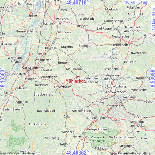
Mühlacker GPS coordinates[2]
48° 56' 51.144" North, 8° 50' 12.3" East
| Map corner | latitude | longitude |
|---|---|---|
| Upper-left | 49.40718°, | 8.13363° |
| Center: | 48.94754°, | 8.83675° |
| Lower-right: | 48.48362°, | 9.53988° |
| Map W x H: | 102.7×102.7 km | = 63.8×63.8mi |
| max Lat: | 55.01917° ⇑83.5% North |
| Mühlacker: | 48.94754° |
| min Lat: | ⇓16.5% South 47.40724° |
| min Long | Mühlacker | max Long |
| 5.92978° | 8.83675° | 14.98853° |
| W 32.6%⇐ | ⇒67.4% E |
Elevation
Elevation of Mühlacker is 225 m = 738 ft, and this is 24.1 m = 79 ft below average elevation for this country.
| Max E: |
1256 m = 4121 ft | 50% |
| Avg. | 249.1 m = 817 ft | |
| Mühlacker | 225 m = 738 ft | |
Min E: |
-5 m = -16 ft | 50% |
See also: Germany elevation on elevation.city.
Geographical zone
Mühlacker is located in North temperate zone (between Tropic of Cancer and the Arctic Circle). Distance of this North polar circle is 1958.7 km =1217.1 mi to North.| Distance of | km | miles | from Mühlacker |
|---|---|---|---|
| North Pole | 4564.6 | 2836.3 | to North |
| Arctic Circle | 1958.7 | 1217.1 | to North |
| Tropic Cancer | 2836.5 | 1762.5 | to South |
| Equator | 5442.5 | 3381.8 | to South |


Nearby cities:
15 places around Mühlacker: (largest is in red/bold)
• Eberdingen
12.1 km =7.5 mi,  128°
128°
• Eutingen an der Enz
7.5 km =4.7 mi,  238°
238°
• Illingen
6.5 km =4 mi,  81°
81°
• Kieselbronn
6.5 km =4 mi,  255°
255°
• Knittlingen
10.4 km =6.5 mi,  325°
325°
• Maulbronn
6.3 km =3.9 mi,  337°
337°
• Mönsheim
9.3 km =5.8 mi,  166°
166°
• Niefern-Öschelbronn
5.2 km =3.2 mi,  228°
228°
• Sternenfels
11.6 km =7.2 mi,  5°
5°
• Vaihingen an der Enz
9.1 km =5.7 mi,  98°
98°
• Wiernsheim
7.2 km =4.5 mi, 172°
• Wimsheim
10.8 km =6.7 mi,  181°
181°
• Wurmberg
9.1 km =5.7 mi,  189°
189°
• Ölbronn-Dürrn
6.7 km =4.2 mi,  288°
288°
• Ötisheim
3.4 km =2.1 mi,  308°
308°
Sources, notices
• [Note1] Compared only with cities in Germany existing in our database
• [Src1] Map data: © OpenStreetMap contributors (CC-BY-SA)
• [Src2] Other city data from geonames.org with taken over terms of usage.
• [Src3] Geographical zone / Annual Mean Temperature by Robert A. Rohde @ Wikipedia
