Knittlingen geodata
Knittlingen (Baden-Württemberg) is a populated place; located in Germany in Europe/Berlin (GMT+2) time zone. With population of 7,454 people, there are 2082 cities with bigger population in this country. Compared to other cities in Germany, 82.7% of cities are located further ↑North; 68.4% of cities are located further →East and 54.9% of cities have higher elevation than Knittlingen. Note1
Administrative division(s):
- Level 1: Baden-Württemberg
- Level 2: Karlsruhe Region
- Level 3: Enzkreis
- Level 4: Knittlingen


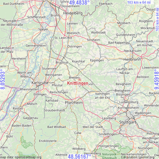
Knittlingen GPS coordinates[2]
49° 1' 29.532" North, 8° 45' 21.816" East
| Map corner | latitude | longitude |
|---|---|---|
| Upper-left | 49.4838°, | 8.05293° |
| Center: | 49.02487°, | 8.75606° |
| Lower-right: | 48.56167°, | 9.45918° |
| Map W x H: | 102.5×102.5 km | = 63.7×63.7mi |
| max Lat: | 55.01917° ⇑82.7% North |
| Knittlingen: | 49.02487° |
| min Lat: | ⇓17.3% South 47.40724° |
| min Long | Knittlingen | max Long |
| 5.92978° | 8.75606° | 14.98853° |
| W 31.6%⇐ | ⇒68.4% E |
Elevation
Elevation of Knittlingen is 190 m = 623 ft, and this is 59.1 m = 194 ft below average elevation for this country.
| Max E: |
1256 m = 4121 ft | 54.9% |
| Avg. | 249.1 m = 817 ft | |
| Knittlingen | 190 m = 623 ft | |
Min E: |
-5 m = -16 ft | 45.1% |
See also: Germany elevation on elevation.city.
Geographical zone
Knittlingen is located in North temperate zone (between Tropic of Cancer and the Arctic Circle). Distance of this North polar circle is 1950.1 km =1211.7 mi to North.| Distance of | km | miles | from Knittlingen |
|---|---|---|---|
| North Pole | 4556 | 2831 | to North |
| Arctic Circle | 1950.1 | 1211.7 | to North |
| Tropic Cancer | 2845.1 | 1767.9 | to South |
| Equator | 5451.1 | 3387.2 | to South |


Nearby cities:
15 places around Knittlingen: (largest is in red/bold)
• Bretten
3.8 km =2.4 mi,  290°
290°
• Dürrenbüchig
7.9 km =4.9 mi,  266°
266°
• Eisingen
10.6 km =6.6 mi,  218°
218°
• Gondelsheim
8.1 km =5 mi,  298°
298°
• Kieselbronn
10.2 km =6.3 mi,  182°
182°
• Kürnbach
8.8 km =5.5 mi,  48°
48°
• Maulbronn
4.5 km =2.8 mi,  129°
129°
• Mühlacker
10.4 km =6.5 mi,  145°
145°
• Oberderdingen
5.7 km =3.5 mi,  37°
37°
• Sternenfels
7.5 km =4.7 mi,  66°
66°
• Sulzfeld
11.5 km =7.1 mi, 39°
• Wössingen
10.9 km =6.8 mi,  262°
262°
• Zaisenhausen
10 km =6.2 mi,  24°
24°
• Ölbronn-Dürrn
6.5 km =4 mi, 183°
• Ötisheim
7.2 km =4.5 mi, 153°
Sources, notices
• [Note1] Compared only with cities in Germany existing in our database
• [Src1] Map data: © OpenStreetMap contributors (CC-BY-SA)
• [Src2] Other city data from geonames.org with taken over terms of usage.
• [Src3] Geographical zone / Annual Mean Temperature by Robert A. Rohde @ Wikipedia
