Mössingen geodata
Mössingen (Baden-Württemberg) is a populated place; located in Germany in Europe/Berlin (GMT+2) time zone. With population of 20,010 people, there are 779 cities with bigger population in this country. Compared to other cities in Germany, 90.2% of cities are located further ↑North; 64.7% of cities are located further →East and 84.4% of cities have lower elevation than Mössingen. Note1
Administrative division(s):
- Level 1: Baden-Württemberg
- Level 2: Tübingen Region
- Level 3: Landkreis Tübingen
- Level 4: Mössingen


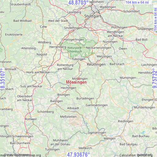
Mössingen GPS coordinates[2]
48° 24' 20.412" North, 9° 3' 15.084" East
| Map corner | latitude | longitude |
|---|---|---|
| Upper-left | 48.8703°, | 8.35107° |
| Center: | 48.40567°, | 9.05419° |
| Lower-right: | 47.93676°, | 9.75732° |
| Map W x H: | 103.8×103.8 km | = 64.5×64.5mi |
| max Lat: | 55.01917° ⇑90.2% North |
| Mössingen: | 48.40567° |
| min Lat: | ⇓9.8% South 47.40724° |
| min Long | Mössingen | max Long |
| 5.92978° | 9.05419° | 14.98853° |
| W 35.3%⇐ | ⇒64.7% E |
Elevation
Elevation of Mössingen is 464 m = 1522 ft, and this is 214.9 m = 705 ft above average elevation for this country.
| Max E: |
1256 m = 4121 ft | 15.6% |
| Mössingen | 464 m 1522 ft | |
| Avg. | 249.1 m = 817 ft | |
Min E: |
-5 m = -16 ft | 84.4% |
See also: Germany elevation on elevation.city.
Geographical zone
Mössingen is located in North temperate zone (between Tropic of Cancer and the Arctic Circle). Distance of this North polar circle is 2019 km =1254.5 mi to North.| Distance of | km | miles | from Mössingen |
|---|---|---|---|
| North Pole | 4624.9 | 2873.8 | to North |
| Arctic Circle | 2019 | 1254.5 | to North |
| Tropic Cancer | 2776.3 | 1725.1 | to South |
| Equator | 5382.2 | 3344.3 | to South |


Nearby cities:
15 places around Mössingen: (largest is in red/bold)
• Bodelshausen
6 km =3.7 mi,  251°
251°
• Burladingen
13.5 km =8.4 mi,  161°
161°
• Dußlingen
5.3 km =3.3 mi,  1°
1°
• Gomaringen
6.1 km =3.8 mi,  30°
30°
• Hechingen
9 km =5.6 mi,  228°
228°
• Hirrlingen
12.3 km =7.6 mi,  273°
273°
• Jungingen
8.7 km =5.4 mi,  186°
186°
• Kusterdingen
13.9 km =8.6 mi,  20°
20°
• Nehren
3 km =1.9 mi, 22°
• Ofterdingen
2 km =1.2 mi,  308°
308°
• Pfullingen
14.4 km =8.9 mi,  62°
62°
• Rangendingen
12.5 km =7.8 mi,  257°
257°
• Rottenburg
11.8 km =7.3 mi, 311°
• Tübingen
13 km =8.1 mi,  359°
359°
• Wannweil
14.2 km =8.8 mi, 29°
Sources, notices
• [Note1] Compared only with cities in Germany existing in our database
• [Src1] Map data: © OpenStreetMap contributors (CC-BY-SA)
• [Src2] Other city data from geonames.org with taken over terms of usage.
• [Src3] Geographical zone / Annual Mean Temperature by Robert A. Rohde @ Wikipedia
