Moorenweis geodata
Moorenweis (Bavaria) is a seat of a fourth-order administrative division; located in Germany in Europe/Berlin (GMT+2) time zone. With population of 3,652 people, there are 3507 cities with bigger population in this country. Compared to other cities in Germany, 93.3% of cities are located further ↑North; 68% of cities are located further ←West and 93.6% of cities have lower elevation than Moorenweis. Note1
Administrative division(s):
- Level 1: Bavaria
- Level 2: Upper Bavaria
- Level 3: Landkreis Fürstenfeldbruck
- Level 4: Moorenweis


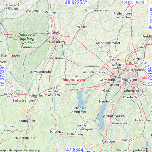
Moorenweis GPS coordinates[2]
48° 9' 20.196" North, 11° 4' 42.636" East
| Map corner | latitude | longitude |
|---|---|---|
| Upper-left | 48.62253°, | 10.37539° |
| Center: | 48.15561°, | 11.07851° |
| Lower-right: | 47.6844°, | 11.78164° |
| Map W x H: | 104.3×104.3 km | = 64.8×64.8mi |
| max Lat: | 55.01917° ⇑93.3% North |
| Moorenweis: | 48.15561° |
| min Lat: | ⇓6.7% South 47.40724° |
| min Long | Moorenweis | max Long |
| 5.92978° | 11.07851° | 14.98853° |
| W 68%⇐ | ⇒32% E |
Elevation
Elevation of Moorenweis is 567 m = 1860 ft, and this is 317.9 m = 1043 ft above average elevation for this country.
| Max E: |
1256 m = 4121 ft | 6.4% |
| Moorenweis | 567 m 1860 ft | |
| Avg. | 249.1 m = 817 ft | |
Min E: |
-5 m = -16 ft | 93.6% |
See also: Germany elevation on elevation.city.
Geographical zone
Moorenweis is located in North temperate zone (between Tropic of Cancer and the Arctic Circle). Distance of this North polar circle is 2046.8 km =1271.8 mi to North.| Distance of | km | miles | from Moorenweis |
|---|---|---|---|
| North Pole | 4652.7 | 2891.1 | to North |
| Arctic Circle | 2046.8 | 1271.8 | to North |
| Tropic Cancer | 2748.5 | 1707.8 | to South |
| Equator | 5354.4 | 3327.1 | to South |


Nearby cities:
15 places around Moorenweis: (largest is in red/bold)
• Adelshofen
4.2 km =2.6 mi,  42°
42°
• Althegnenberg
8.7 km =5.4 mi,  354°
354°
• Eching
8.8 km =5.5 mi,  162°
162°
• Egling
8.3 km =5.2 mi,  294°
294°
• Eresing
8.6 km =5.3 mi,  207°
207°
• Geltendorf
5.5 km =3.4 mi,  218°
218°
• Grafrath
7.8 km =4.8 mi,  123°
123°
• Hattenhofen
7.9 km =4.9 mi,  20°
20°
• Jesenwang
4.2 km =2.6 mi,  73°
73°
• Kottgeisering
5.9 km =3.7 mi,  136°
136°
• Landsberied
6.7 km =4.2 mi,  79°
79°
• Mammendorf
8.6 km =5.3 mi,  46°
46°
• Schöngeising
9.4 km =5.8 mi,  99°
99°
• Steindorf
8.9 km =5.5 mi,  319°
319°
• Türkenfeld
5.6 km =3.5 mi,  176°
176°
Sources, notices
• [Note1] Compared only with cities in Germany existing in our database
• [Src1] Map data: © OpenStreetMap contributors (CC-BY-SA)
• [Src2] Other city data from geonames.org with taken over terms of usage.
• [Src3] Geographical zone / Annual Mean Temperature by Robert A. Rohde @ Wikipedia
