Mammendorf geodata
Mammendorf (Bavaria) is a seat of a fourth-order administrative division; located in Germany in Europe/Berlin (GMT+2) time zone. With population of 4,540 people, there are 3019 cities with bigger population in this country. Compared to other cities in Germany, 92.6% of cities are located further ↑North; 69.3% of cities are located further ←West and 91.6% of cities have lower elevation than Mammendorf. Note1
Administrative division(s):
- Level 1: Bavaria
- Level 2: Upper Bavaria
- Level 3: Landkreis Fürstenfeldbruck
- Level 4: Mammendorf


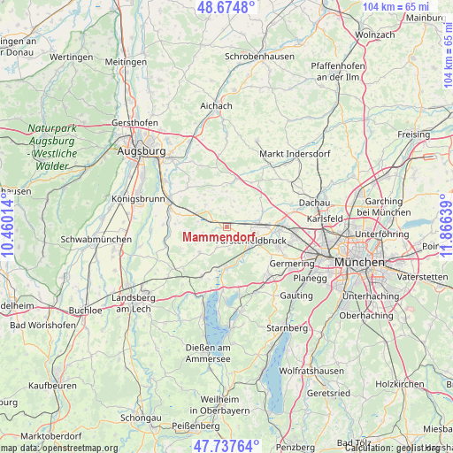
Mammendorf GPS coordinates[2]
48° 12' 30.096" North, 11° 9' 47.736" East
| Map corner | latitude | longitude |
|---|---|---|
| Upper-left | 48.6748°, | 10.46014° |
| Center: | 48.20836°, | 11.16326° |
| Lower-right: | 47.73764°, | 11.86639° |
| Map W x H: | 104.2×104.2 km | = 64.7×64.7mi |
| max Lat: | 55.01917° ⇑92.6% North |
| Mammendorf: | 48.20836° |
| min Lat: | ⇓7.4% South 47.40724° |
| min Long | Mammendorf | max Long |
| 5.92978° | 11.16326° | 14.98853° |
| W 69.3%⇐ | ⇒30.7% E |
Elevation
Elevation of Mammendorf is 536 m = 1759 ft, and this is 286.9 m = 941 ft above average elevation for this country.
| Max E: |
1256 m = 4121 ft | 8.4% |
| Mammendorf | 536 m 1759 ft | |
| Avg. | 249.1 m = 817 ft | |
Min E: |
-5 m = -16 ft | 91.6% |
See also: Germany elevation on elevation.city.
Geographical zone
Mammendorf is located in North temperate zone (between Tropic of Cancer and the Arctic Circle). Distance of this North polar circle is 2040.9 km =1268.2 mi to North.| Distance of | km | miles | from Mammendorf |
|---|---|---|---|
| North Pole | 4646.8 | 2887.4 | to North |
| Arctic Circle | 2040.9 | 1268.2 | to North |
| Tropic Cancer | 2754.3 | 1711.4 | to South |
| Equator | 5360.3 | 3330.7 | to South |


Nearby cities:
15 places around Mammendorf: (largest is in red/bold)
• Adelshofen
4.4 km =2.7 mi,  231°
231°
• Althegnenberg
7.7 km =4.8 mi,  291°
291°
• Egenhofen
8.3 km =5.2 mi,  1°
1°
• Emmering
9.3 km =5.8 mi,  107°
107°
• Fürstenfeldbruck
7.5 km =4.7 mi,  115°
115°
• Grafrath
10.2 km =6.3 mi,  178°
178°
• Hattenhofen
3.9 km =2.4 mi, 293°
• Jesenwang
5.1 km =3.2 mi,  205°
205°
• Kottgeisering
10.4 km =6.5 mi,  192°
192°
• Landsberied
4.6 km =2.9 mi, 176°
• Maisach
7.7 km =4.8 mi,  83°
83°
• Mittelstetten
6.6 km =4.1 mi,  314°
314°
• Moorenweis
8.6 km =5.3 mi, 226°
• Oberschweinbach
3.4 km =2.1 mi,  350°
350°
• Schöngeising
8 km =5 mi,  157°
157°
Sources, notices
• [Note1] Compared only with cities in Germany existing in our database
• [Src1] Map data: © OpenStreetMap contributors (CC-BY-SA)
• [Src2] Other city data from geonames.org with taken over terms of usage.
• [Src3] Geographical zone / Annual Mean Temperature by Robert A. Rohde @ Wikipedia
