Marzahn geodata
Marzahn (Berlin) is a section of populated place; located in Germany in Europe/Berlin (GMT+2) time zone. With population of 103,768 people, there are 93 cities with bigger population in this country. Compared to other cities in Germany, 78% of cities are located further ↓South; 96.1% of cities are located further ←West and 75.3% of cities have higher elevation than Marzahn. Note1


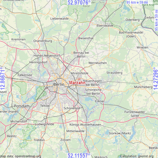
Marzahn GPS coordinates[2]
52° 32' 42.9" North, 13° 34' 11.388" East
| Map corner | latitude | longitude |
|---|---|---|
| Upper-left | 52.97076°, | 12.86671° |
| Center: | 52.54525°, | 13.56983° |
| Lower-right: | 52.11557°, | 14.27296° |
| Map W x H: | 95.1×95.1 km | = 59.1×59.1mi |
| max Lat: | 55.01917° ⇑22% North |
| Marzahn: | 52.54525° |
| min Lat: | ⇓78% South 47.40724° |
| min Long | Marzahn | max Long |
| 5.92978° | 13.56983° | 14.98853° |
| W 96.1%⇐ | ⇒3.9% E |
Elevation
Elevation of Marzahn is 62 m = 203 ft, and this is 187.1 m = 614 ft below average elevation for this country.
| Max E: |
1256 m = 4121 ft | 75.3% |
| Avg. | 249.1 m = 817 ft | |
| Marzahn | 62 m = 203 ft | |
Min E: |
-5 m = -16 ft | 24.7% |
See also: Marzahn elevation on elevation.city.
Geographical zone
Marzahn is located in North temperate zone (between Tropic of Cancer and the Arctic Circle). Distance of this North polar circle is 1558.7 km =968.5 mi to North.| Distance of | km | miles | from Marzahn |
|---|---|---|---|
| North Pole | 4164.6 | 2587.8 | to North |
| Arctic Circle | 1558.7 | 968.5 | to North |
| Tropic Cancer | 3236.6 | 2011.1 | to South |
| Equator | 5842.5 | 3630.4 | to South |


Nearby cities:
15 places around Marzahn: (largest is in red/bold)
• Ahrensfelde
3.5 km =2.2 mi,  10°
10°
• Alt-Hohenschönhausen
4.6 km =2.9 mi,  271°
271°
• Biesdorf
4.2 km =2.6 mi,  195°
195°
• Falkenberg
3 km =1.9 mi,  327°
327°
• Fennpfuhl
6.8 km =4.2 mi,  254°
254°
• Friedrichsfelde
6.1 km =3.8 mi,  223°
223°
• Hellersdorf
3 km =1.9 mi,  116°
116°
• Kaulsdorf
3.4 km =2.1 mi,  157°
157°
• Lichtenberg
5.9 km =3.7 mi,  233°
233°
• Mahlsdorf
5 km =3.1 mi,  143°
143°
• Malchow
7.2 km =4.5 mi,  305°
305°
• Neu-Hohenschönhausen
4.6 km =2.9 mi,  301°
301°
• Rummelsburg
7.1 km =4.4 mi, 226°
• Wartenberg
5 km =3.1 mi, 312°
• Weißensee
7.1 km =4.4 mi,  279°
279°
Sources, notices
• [Note1] Compared only with cities in Germany existing in our database
• [Src1] Map data: © OpenStreetMap contributors (CC-BY-SA)
• [Src2] Other city data from geonames.org with taken over terms of usage.
• [Src3] Geographical zone / Annual Mean Temperature by Robert A. Rohde @ Wikipedia
