Lichtenberg geodata
Lichtenberg (Berlin) is a section of populated place; located in Germany in Europe/Berlin (GMT+2) time zone. With population of 32,888 people, there are 412 cities with bigger population in this country. Compared to other cities in Germany, 77.5% of cities are located further ↓South; 95.7% of cities are located further ←West and 78.3% of cities have higher elevation than Lichtenberg. Note1


Lichtenberg GPS coordinates[2]
52° 30' 50.22" North, 13° 29' 59.1" East
| Map corner | latitude | longitude |
|---|---|---|
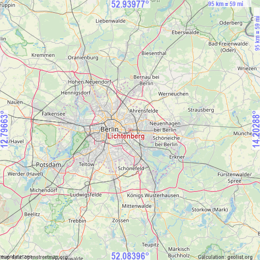
| Upper-left | 52.93977°, | 12.79663° |
| Center: | 52.51395°, | 13.49975° |
| Lower-right: | 52.08396°, | 14.20288° |
| Map W x H: | 95.2×95.2 km | = 59.2×59.2mi |
| max Lat: | 55.01917° ⇑22.5% North |
| Lichtenberg: | 52.51395° |
| min Lat: | ⇓77.5% South 47.40724° |
| min Long | Lichtenberg | max Long |
| 5.92978° | 13.49975° | 14.98853° |
| W 95.7%⇐ | ⇒4.3% E |
Elevation
Elevation of Lichtenberg is 52 m = 171 ft, and this is 197.1 m = 647 ft below average elevation for this country.
| Max E: |
1256 m = 4121 ft | 78.3% |
| Avg. | 249.1 m = 817 ft | |
| Lichtenberg | 52 m = 171 ft | |
Min E: |
-5 m = -16 ft | 21.7% |
See also: Germany elevation on elevation.city.
Geographical zone
Lichtenberg is located in North temperate zone (between Tropic of Cancer and the Arctic Circle). Distance of this North polar circle is 1562.2 km =970.7 mi to North.| Distance of | km | miles | from Lichtenberg |
|---|---|---|---|
| North Pole | 4168.1 | 2589.9 | to North |
| Arctic Circle | 1562.2 | 970.7 | to North |
| Tropic Cancer | 3233.1 | 2009 | to South |
| Equator | 5839 | 3628.2 | to South |


Nearby cities:
15 places around Lichtenberg: (largest is in red/bold)
• Alt-Hohenschönhausen
3.6 km =2.2 mi,  1°
1°
• Alt-Treptow
4 km =2.5 mi,  224°
224°
• Baumschulenweg
5.4 km =3.4 mi,  190°
190°
• Berlin Treptow
4.4 km =2.7 mi,  238°
238°
• Biesdorf
3.7 km =2.3 mi,  98°
98°
• Fennpfuhl
2.5 km =1.6 mi,  312°
312°
• Friedrichsfelde
1.1 km =0.7 mi,  148°
148°
• Friedrichshain
3 km =1.9 mi,  273°
273°
• Karlshorst
4 km =2.5 mi, 146°
• Marzahn
5.9 km =3.7 mi,  53°
53°
• Neu-Hohenschönhausen
5.9 km =3.7 mi,  8°
8°
• Plänterwald
4.1 km =2.5 mi,  206°
206°
• Prenzlauer Berg
5.8 km =3.6 mi,  298°
298°
• Rummelsburg
1.5 km =0.9 mi,  197°
197°
• Weißensee
5.2 km =3.2 mi,  334°
334°
Sources, notices
• [Note1] Compared only with cities in Germany existing in our database
• [Src1] Map data: © OpenStreetMap contributors (CC-BY-SA)
• [Src2] Other city data from geonames.org with taken over terms of usage.
• [Src3] Geographical zone / Annual Mean Temperature by Robert A. Rohde @ Wikipedia
