Leiferde geodata
Leiferde (Lower Saxony) is a populated place; located in Germany in Europe/Berlin (GMT+2) time zone. With population of 4,451 people, there are 3061 cities with bigger population in this country. Compared to other cities in Germany, 74.1% of cities are located further ↓South; 59.1% of cities are located further ←West and 72.3% of cities have higher elevation than Leiferde. Note1
Administrative division(s):
- Level 1: Lower Saxony
- Level 3: Kreisfreie Stadt Braunschweig
- Level 4: Braunschweig


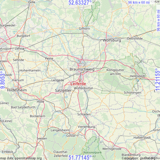
Leiferde GPS coordinates[2]
52° 12' 16.02" North, 10° 30' 30.312" East
| Map corner | latitude | longitude |
|---|---|---|
| Upper-left | 52.63327°, | 9.8053° |
| Center: | 52.20445°, | 10.50842° |
| Lower-right: | 51.77145°, | 11.21155° |
| Map W x H: | 95.8×95.8 km | = 59.5×59.5mi |
| max Lat: | 55.01917° ⇑25.9% North |
| Leiferde: | 52.20445° |
| min Lat: | ⇓74.1% South 47.40724° |
| min Long | Leiferde | max Long |
| 5.92978° | 10.50842° | 14.98853° |
| W 59.1%⇐ | ⇒40.9% E |
Elevation
Elevation of Leiferde is 76 m = 249 ft, and this is 173.1 m = 568 ft below average elevation for this country.
| Max E: |
1256 m = 4121 ft | 72.3% |
| Avg. | 249.1 m = 817 ft | |
| Leiferde | 76 m = 249 ft | |
Min E: |
-5 m = -16 ft | 27.7% |
See also: Germany elevation on elevation.city.
Geographical zone
Leiferde is located in North temperate zone (between Tropic of Cancer and the Arctic Circle). Distance of this North polar circle is 1596.6 km =992.1 mi to North.| Distance of | km | miles | from Leiferde |
|---|---|---|---|
| North Pole | 4202.5 | 2611.3 | to North |
| Arctic Circle | 1596.6 | 992.1 | to North |
| Tropic Cancer | 3198.7 | 1987.6 | to South |
| Equator | 5804.6 | 3606.8 | to South |


Nearby cities:
15 places around Leiferde: (largest is in red/bold)
• Braunschweig
6.9 km =4.3 mi,  10°
10°
• Cramme
11 km =6.8 mi,  202°
202°
• Cremlingen
10.9 km =6.8 mi,  62°
62°
• Dettum
11.4 km =7.1 mi,  108°
108°
• Dorstadt
12.3 km =7.6 mi,  161°
161°
• Erkerode
13.7 km =8.5 mi,  89°
89°
• Flöthe
13.6 km =8.5 mi,  187°
187°
• Kissenbrück
11.9 km =7.4 mi,  152°
152°
• Ohrum
10 km =6.2 mi, 158°
• Salzgitter
8.2 km =5.1 mi,  230°
230°
• Sickte
9.3 km =5.8 mi,  80°
80°
• Vechelde
11.6 km =7.2 mi,  302°
302°
• Veltheim
12 km =7.5 mi, 82°
• Wittmar
12.2 km =7.6 mi,  132°
132°
• Wolfenbüttel
5 km =3.1 mi, 153°
Sources, notices
• [Note1] Compared only with cities in Germany existing in our database
• [Src1] Map data: © OpenStreetMap contributors (CC-BY-SA)
• [Src2] Other city data from geonames.org with taken over terms of usage.
• [Src3] Geographical zone / Annual Mean Temperature by Robert A. Rohde @ Wikipedia
