Salzgitter geodata
Salzgitter (Lower Saxony) is a populated place; located in Germany in Europe/Berlin (GMT+2) time zone. With population of 101,079 people, there are 97 cities with bigger population in this country. Compared to other cities in Germany, 73.6% of cities are located further ↓South; 57.3% of cities are located further ←West and 68.7% of cities have higher elevation than Salzgitter. Note1
Administrative division(s):
- Level 1: Lower Saxony
- Level 3: Kreisfreie Stadt Salzgitter
- Level 4: Salzgitter


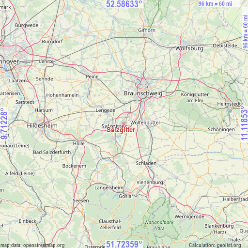
Salzgitter GPS coordinates[2]
52° 9' 25.38" North, 10° 24' 55.44" East
| Map corner | latitude | longitude |
|---|---|---|
| Upper-left | 52.58633°, | 9.71228° |
| Center: | 52.15705°, | 10.4154° |
| Lower-right: | 51.72359°, | 11.11853° |
| Map W x H: | 95.9×95.9 km | = 59.6×59.6mi |
| max Lat: | 55.01917° ⇑26.4% North |
| Salzgitter: | 52.15705° |
| min Lat: | ⇓73.6% South 47.40724° |
| min Long | Salzgitter | max Long |
| 5.92978° | 10.4154° | 14.98853° |
| W 57.3%⇐ | ⇒42.7% E |
Elevation
Elevation of Salzgitter is 99 m = 325 ft, and this is 150.1 m = 492 ft below average elevation for this country.
| Max E: |
1256 m = 4121 ft | 68.7% |
| Avg. | 249.1 m = 817 ft | |
| Salzgitter | 99 m = 325 ft | |
Min E: |
-5 m = -16 ft | 31.3% |
See also: Salzgitter elevation on elevation.city.
Geographical zone
Salzgitter is located in North temperate zone (between Tropic of Cancer and the Arctic Circle). Distance of this North polar circle is 1601.9 km =995.4 mi to North.| Distance of | km | miles | from Salzgitter |
|---|---|---|---|
| North Pole | 4207.7 | 2614.5 | to North |
| Arctic Circle | 1601.9 | 995.4 | to North |
| Tropic Cancer | 3193.4 | 1984.3 | to South |
| Equator | 5799.3 | 3603.5 | to South |


Nearby cities:
15 places around Salzgitter: (largest is in red/bold)
• Braunschweig
14.3 km =8.9 mi,  32°
32°
• Burgdorf
13.6 km =8.5 mi,  264°
264°
• Cramme
5.3 km =3.3 mi,  156°
156°
• Dorstadt
12.1 km =7.5 mi,  121°
121°
• Elbe
12.2 km =7.6 mi,  227°
227°
• Flöthe
9.4 km =5.8 mi,  150°
150°
• Heiningen
13.6 km =8.5 mi,  135°
135°
• Kissenbrück
13 km =8.1 mi,  113°
113°
• Leiferde
8.2 km =5.1 mi,  50°
50°
• Lengede
9.1 km =5.7 mi,  305°
305°
• Ohrum
10.8 km =6.7 mi, 111°
• Söhlde
13 km =8.1 mi,  285°
285°
• Vechelde
12 km =7.5 mi,  343°
343°
• Werlaburgdorf
14.5 km =9 mi, 145°
• Wolfenbüttel
8.6 km =5.3 mi,  84°
84°
Sources, notices
• [Note1] Compared only with cities in Germany existing in our database
• [Src1] Map data: © OpenStreetMap contributors (CC-BY-SA)
• [Src2] Other city data from geonames.org with taken over terms of usage.
• [Src3] Geographical zone / Annual Mean Temperature by Robert A. Rohde @ Wikipedia
