Cramme geodata
Cramme (Lower Saxony) is a seat of a fourth-order administrative division; located in Germany in Europe/Berlin (GMT+2) time zone. With population of 959 people, there are 7312 cities with bigger population in this country. Compared to other cities in Germany, 73.1% of cities are located further ↓South; 58% of cities are located further ←West and 67.6% of cities have higher elevation than Cramme. Note1


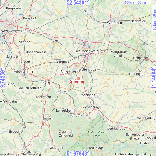
Cramme GPS coordinates[2]
52° 6' 47.916" North, 10° 26' 48.156" East
| Map corner | latitude | longitude |
|---|---|---|
| Upper-left | 52.54301°, | 9.74359° |
| Center: | 52.11331°, | 10.44671° |
| Lower-right: | 51.67943°, | 11.14984° |
| Map W x H: | 96×96 km | = 59.7×59.7mi |
| max Lat: | 55.01917° ⇑26.9% North |
| Cramme: | 52.11331° |
| min Lat: | ⇓73.1% South 47.40724° |
| min Long | Cramme | max Long |
| 5.92978° | 10.44671° | 14.98853° |
| W 58%⇐ | ⇒42% E |
Elevation
Elevation of Cramme is 104 m = 341 ft, and this is 145.1 m = 476 ft below average elevation for this country.
| Max E: |
1256 m = 4121 ft | 67.6% |
| Avg. | 249.1 m = 817 ft | |
| Cramme | 104 m = 341 ft | |
Min E: |
-5 m = -16 ft | 32.4% |
See also: Germany elevation on elevation.city.
Geographical zone
Cramme is located in North temperate zone (between Tropic of Cancer and the Arctic Circle). Distance of this North polar circle is 1606.7 km =998.4 mi to North.| Distance of | km | miles | from Cramme |
|---|---|---|---|
| North Pole | 4212.6 | 2617.6 | to North |
| Arctic Circle | 1606.7 | 998.4 | to North |
| Tropic Cancer | 3188.5 | 1981.2 | to South |
| Equator | 5794.5 | 3600.5 | to South |


Nearby cities:
15 places around Cramme: (largest is in red/bold)
• Achim
12.7 km =7.9 mi,  118°
118°
• Börßum
10.6 km =6.6 mi, 117°
• Dorstadt
8.3 km =5.2 mi,  100°
100°
• Elbe
11.6 km =7.2 mi,  253°
253°
• Flöthe
4.2 km =2.6 mi,  143°
143°
• Gielde
9.2 km =5.7 mi,  159°
159°
• Heiningen
8.9 km =5.5 mi, 123°
• Kissenbrück
9.8 km =6.1 mi,  92°
92°
• Leiferde
11 km =6.8 mi,  22°
22°
• Liebenburg
10.2 km =6.3 mi,  185°
185°
• Ohrum
8 km =5 mi,  83°
83°
• Salzgitter
5.3 km =3.3 mi,  336°
336°
• Schladen
12 km =7.5 mi,  147°
147°
• Werlaburgdorf
9.4 km =5.8 mi, 138°
• Wolfenbüttel
8.6 km =5.3 mi,  48°
48°
Sources, notices
• [Note1] Compared only with cities in Germany existing in our database
• [Src1] Map data: © OpenStreetMap contributors (CC-BY-SA)
• [Src2] Other city data from geonames.org with taken over terms of usage.
• [Src3] Geographical zone / Annual Mean Temperature by Robert A. Rohde @ Wikipedia
