Lankau geodata
Lankau (Schleswig-Holstein) is a seat of a fourth-order administrative division; located in Germany in Europe/Berlin (GMT+2) time zone. With population of 515 people, there are 9292 cities with bigger population in this country. Compared to other cities in Germany, 88% of cities are located further ↓South; 61.9% of cities are located further ←West and 79.2% of cities have higher elevation than Lankau. Note1
Administrative division(s):
- Level 1: Schleswig-Holstein
- Level 3: Kreis Herzogtum Lauenburg
- Level 4: Lankau


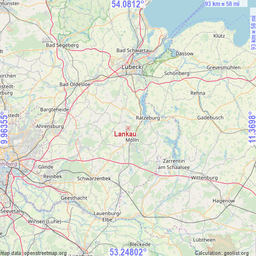
Lankau GPS coordinates[2]
53° 40' 0.012" North, 10° 40' 0.012" East
| Map corner | latitude | longitude |
|---|---|---|
| Upper-left | 54.0812°, | 9.96355° |
| Center: | 53.66667°, | 10.66667° |
| Lower-right: | 53.24802°, | 11.3698° |
| Map W x H: | 92.6×92.6 km | = 57.5×57.5mi |
| max Lat: | 55.01917° ⇑12% North |
| Lankau: | 53.66667° |
| min Lat: | ⇓88% South 47.40724° |
| min Long | Lankau | max Long |
| 5.92978° | 10.66667° | 14.98853° |
| W 61.9%⇐ | ⇒38.1% E |
Elevation
Elevation of Lankau is 49 m = 161 ft, and this is 200.1 m = 656 ft below average elevation for this country.
| Max E: |
1256 m = 4121 ft | 79.2% |
| Avg. | 249.1 m = 817 ft | |
| Lankau | 49 m = 161 ft | |
Min E: |
-5 m = -16 ft | 20.8% |
See also: Germany elevation on elevation.city.
Geographical zone
Lankau is located in North temperate zone (between Tropic of Cancer and the Arctic Circle). Distance of this North polar circle is 1434 km =891 mi to North.| Distance of | km | miles | from Lankau |
|---|---|---|---|
| North Pole | 4039.9 | 2510.3 | to North |
| Arctic Circle | 1434 | 891 | to North |
| Tropic Cancer | 3361.3 | 2088.6 | to South |
| Equator | 5967.2 | 3707.8 | to South |


Nearby cities:
15 places around Lankau: (largest is in red/bold)
• Albsfelde
2.9 km =1.8 mi,  49°
49°
• Alt Mölln
4.9 km =3 mi,  183°
183°
• Behlendorf
3.7 km =2.3 mi,  0°
0°
• Bälau
6.5 km =4 mi,  210°
210°
• Fredeburg
3.3 km =2.1 mi,  90°
90°
• Giesensdorf
2.9 km =1.8 mi, 49°
• Göldenitz
6 km =3.7 mi,  338°
338°
• Harmsdorf
5 km =3.1 mi,  41°
41°
• Kulpin
5.2 km =3.2 mi,  21°
21°
• Kühsen
3.8 km =2.4 mi,  299°
299°
• Mölln
5.7 km =3.5 mi,  166°
166°
• Nusse
5.6 km =3.5 mi,  258°
258°
• Panten
3.3 km =2.1 mi,  270°
270°
• Poggensee
5.8 km =3.6 mi,  251°
251°
• Schmilau
6 km =3.7 mi, 94°
Sources, notices
• [Note1] Compared only with cities in Germany existing in our database
• [Src1] Map data: © OpenStreetMap contributors (CC-BY-SA)
• [Src2] Other city data from geonames.org with taken over terms of usage.
• [Src3] Geographical zone / Annual Mean Temperature by Robert A. Rohde @ Wikipedia
