Giesensdorf geodata
Giesensdorf (Schleswig-Holstein) is a seat of a fourth-order administrative division; located in Germany in Europe/Berlin (GMT+2) time zone. With population of 93 people, there are 10861 cities with bigger population in this country. Compared to other cities in Germany, 88.3% of cities are located further ↓South; 62.4% of cities are located further ←West and 83.2% of cities have higher elevation than Giesensdorf. Note1
Administrative division(s):
- Level 1: Schleswig-Holstein
- Level 3: Kreis Herzogtum Lauenburg
- Level 4: Giesensdorf


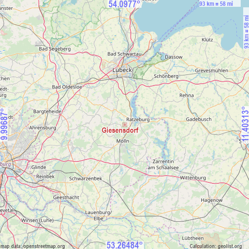
Giesensdorf GPS coordinates[2]
53° 40' 59.988" North, 10° 42' 0" East
| Map corner | latitude | longitude |
|---|---|---|
| Upper-left | 54.0977°, | 9.99687° |
| Center: | 53.68333°, | 10.7° |
| Lower-right: | 53.26484°, | 11.40313° |
| Map W x H: | 92.6×92.6 km | = 57.5×57.5mi |
| max Lat: | 55.01917° ⇑11.7% North |
| Giesensdorf: | 53.68333° |
| min Lat: | ⇓88.3% South 47.40724° |
| min Long | Giesensdorf | max Long |
| 5.92978° | 10.7° | 14.98853° |
| W 62.4%⇐ | ⇒37.6% E |
Elevation
Elevation of Giesensdorf is 39 m = 128 ft, and this is 210.1 m = 689 ft below average elevation for this country.
| Max E: |
1256 m = 4121 ft | 83.2% |
| Avg. | 249.1 m = 817 ft | |
| Giesensdorf | 39 m = 128 ft | |
Min E: |
-5 m = -16 ft | 16.8% |
See also: Germany elevation on elevation.city.
Geographical zone
Giesensdorf is located in North temperate zone (between Tropic of Cancer and the Arctic Circle). Distance of this North polar circle is 1432.1 km =889.9 mi to North.| Distance of | km | miles | from Giesensdorf |
|---|---|---|---|
| North Pole | 4038 | 2509.1 | to North |
| Arctic Circle | 1432.1 | 889.9 | to North |
| Tropic Cancer | 3363.1 | 2089.7 | to South |
| Equator | 5969 | 3709 | to South |


Nearby cities:
15 places around Giesensdorf: (largest is in red/bold)
• Albsfelde
0 km =0 mi,  0°
0°
• Behlendorf
2.9 km =1.8 mi,  310°
310°
• Berkenthin
6.5 km =4 mi,  329°
329°
• Buchholz
6.5 km =4 mi,  30°
30°
• Einhaus
4.3 km =2.7 mi, 30°
• Fredeburg
2.2 km =1.4 mi,  149°
149°
• Göldenitz
5.7 km =3.5 mi, 310°
• Harmsdorf
2.2 km =1.4 mi, 30°
• Kulpin
3 km =1.9 mi,  353°
353°
• Kühsen
5.5 km =3.4 mi,  270°
270°
• Lankau
2.9 km =1.8 mi,  229°
229°
• Panten
5.8 km =3.6 mi,  251°
251°
• Ratzeburg
5.1 km =3.2 mi,  69°
69°
• Römnitz
5.7 km =3.5 mi,  49°
49°
• Schmilau
4.4 km =2.7 mi,  121°
121°
Sources, notices
• [Note1] Compared only with cities in Germany existing in our database
• [Src1] Map data: © OpenStreetMap contributors (CC-BY-SA)
• [Src2] Other city data from geonames.org with taken over terms of usage.
• [Src3] Geographical zone / Annual Mean Temperature by Robert A. Rohde @ Wikipedia
