Landau in der Pfalz geodata
Landau in der Pfalz (Rheinland-Pfalz) is a seat of a third-order administrative division; located in Germany in Europe/Berlin (GMT+2) time zone. With population of 41,612 people, there are 304 cities with bigger population in this country. Compared to other cities in Germany, 80.4% of cities are located further ↑North; 75.1% of cities are located further →East and 61.3% of cities have higher elevation than Landau in der Pfalz. Note1
Administrative division(s):
- Level 1: Rheinland-Pfalz
- Level 3: Kreisfreie Stadt Landau in der Pfalz
- Level 4: Landau in der Pfalz


Landau in der Pfalz GPS coordinates[2]
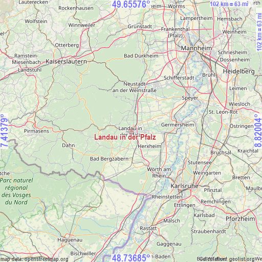
49° 11' 54.384" North, 8° 7' 0.912" East
| Map corner | latitude | longitude |
|---|---|---|
| Upper-left | 49.65576°, | 7.41379° |
| Center: | 49.19844°, | 8.11692° |
| Lower-right: | 48.73685°, | 8.82004° |
| Map W x H: | 102.2×102.2 km | = 63.5×63.5mi |
| max Lat: | 55.01917° ⇑80.4% North |
| Landau in der Pfalz: | 49.19844° |
| min Lat: | ⇓19.6% South 47.40724° |
| min Long | Landau in der P | max Long |
| 5.92978° | 8.11692° | 14.98853° |
| W 24.9%⇐ | ⇒75.1% E |
Elevation
Elevation of Landau in der Pfalz is 144 m = 472 ft, and this is 105.1 m = 345 ft below average elevation for this country.
| Max E: |
1256 m = 4121 ft | 61.3% |
| Avg. | 249.1 m = 817 ft | |
| Landau in der Pfalz | 144 m = 472 ft | |
Min E: |
-5 m = -16 ft | 38.7% |
See also: Landau in der Pfalz elevation on elevation.city.
Geographical zone
Landau in der Pfalz is located in North temperate zone (between Tropic of Cancer and the Arctic Circle). Distance of this North polar circle is 1930.8 km =1199.7 mi to North.| Distance of | km | miles | from Landau in der Pfalz |
|---|---|---|---|
| North Pole | 4536.7 | 2819 | to North |
| Arctic Circle | 1930.8 | 1199.7 | to North |
| Tropic Cancer | 2864.4 | 1779.9 | to South |
| Equator | 5470.4 | 3399.1 | to South |


Nearby cities:
15 places around Landau in der Pfalz: (largest is in red/bold)
• Birkweiler
5.7 km =3.5 mi,  275°
275°
• Bornheim
4.3 km =2.7 mi,  51°
51°
• Böchingen
4.6 km =2.9 mi,  338°
338°
• Essingen
5.9 km =3.7 mi, 45°
• Flemlingen
5.2 km =3.2 mi, 342°
• Frankweiler
5.4 km =3.4 mi,  307°
307°
• Gleisweiler
6 km =3.7 mi,  324°
324°
• Ilbesheim
4.9 km =3 mi,  249°
249°
• Impflingen
4 km =2.5 mi,  183°
183°
• Insheim
5 km =3.1 mi,  153°
153°
• Knöringen
4.8 km =3 mi,  24°
24°
• Offenbach an der Queich
5.9 km =3.7 mi,  93°
93°
• Roschbach
5.3 km =3.3 mi,  1°
1°
• Siebeldingen
4.9 km =3 mi, 283°
• Walsheim
4.4 km =2.7 mi,  9°
9°
Sources, notices
• [Note1] Compared only with cities in Germany existing in our database
• [Src1] Map data: © OpenStreetMap contributors (CC-BY-SA)
• [Src2] Other city data from geonames.org with taken over terms of usage.
• [Src3] Geographical zone / Annual Mean Temperature by Robert A. Rohde @ Wikipedia
