Impflingen geodata
Impflingen (Rheinland-Pfalz) is a seat of a fourth-order administrative division; located in Germany in Europe/Berlin (GMT+2) time zone. With population of 835 people, there are 7757 cities with bigger population in this country. Compared to other cities in Germany, 80.9% of cities are located further ↑North; 75.3% of cities are located further →East and 59.7% of cities have higher elevation than Impflingen. Note1
Administrative division(s):
- Level 1: Rheinland-Pfalz
- Level 3: Landkreis Südliche Weinstraße
- Level 4: Impflingen


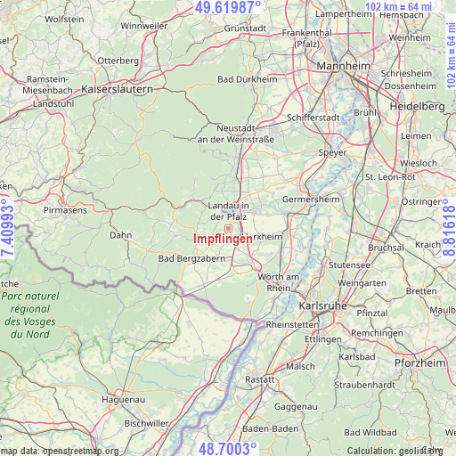
Impflingen GPS coordinates[2]
49° 9' 43.992" North, 8° 6' 47.016" East
| Map corner | latitude | longitude |
|---|---|---|
| Upper-left | 49.61987°, | 7.40993° |
| Center: | 49.16222°, | 8.11306° |
| Lower-right: | 48.7003°, | 8.81618° |
| Map W x H: | 102.2×102.2 km | = 63.5×63.5mi |
| max Lat: | 55.01917° ⇑80.9% North |
| Impflingen: | 49.16222° |
| min Lat: | ⇓19.1% South 47.40724° |
| min Long | Impflingen | max Long |
| 5.92978° | 8.11306° | 14.98853° |
| W 24.7%⇐ | ⇒75.3% E |
Elevation
Elevation of Impflingen is 155 m = 509 ft, and this is 94.1 m = 309 ft below average elevation for this country.
| Max E: |
1256 m = 4121 ft | 59.7% |
| Avg. | 249.1 m = 817 ft | |
| Impflingen | 155 m = 509 ft | |
Min E: |
-5 m = -16 ft | 40.3% |
See also: Germany elevation on elevation.city.
Geographical zone
Impflingen is located in North temperate zone (between Tropic of Cancer and the Arctic Circle). Distance of this North polar circle is 1934.8 km =1202.2 mi to North.| Distance of | km | miles | from Impflingen |
|---|---|---|---|
| North Pole | 4540.7 | 2821.5 | to North |
| Arctic Circle | 1934.8 | 1202.2 | to North |
| Tropic Cancer | 2860.4 | 1777.4 | to South |
| Equator | 5466.3 | 3396.6 | to South |


Nearby cities:
15 places around Impflingen: (largest is in red/bold)
• Billigheim-Ingenheim
3.3 km =2.1 mi,  209°
209°
• Birkweiler
7.1 km =4.4 mi,  310°
310°
• Eschbach
7 km =4.3 mi,  281°
281°
• Göcklingen
5.2 km =3.2 mi,  269°
269°
• Heuchelheim-Klingen
4.6 km =2.9 mi,  245°
245°
• Ilbesheim
4.9 km =3 mi,  297°
297°
• Insheim
2.5 km =1.6 mi,  100°
100°
• Landau in der Pfalz
4 km =2.5 mi,  3°
3°
• Leinsweiler
7.2 km =4.5 mi,  288°
288°
• Offenbach an der Queich
7.2 km =4.5 mi,  59°
59°
• Ranschbach
7.2 km =4.5 mi, 301°
• Rohrbach
3.1 km =1.9 mi,  158°
158°
• Siebeldingen
6.9 km =4.3 mi,  319°
319°
• Steinweiler
5 km =3.1 mi, 155°
• Winden
7.2 km =4.5 mi,  177°
177°
Sources, notices
• [Note1] Compared only with cities in Germany existing in our database
• [Src1] Map data: © OpenStreetMap contributors (CC-BY-SA)
• [Src2] Other city data from geonames.org with taken over terms of usage.
• [Src3] Geographical zone / Annual Mean Temperature by Robert A. Rohde @ Wikipedia
