Kolkwitz geodata
Kolkwitz (Brandenburg) is a seat of a fourth-order administrative division; located in Germany in Europe/Berlin (GMT+2) time zone. With population of 10,225 people, there are 1599 cities with bigger population in this country. Compared to other cities in Germany, 69.4% of cities are located further ↓South; 98.8% of cities are located further ←West and 73.6% of cities have higher elevation than Kolkwitz. Note1


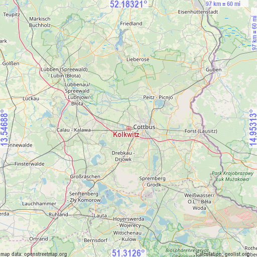
Kolkwitz GPS coordinates[2]
51° 45' 0" North, 14° 15' 0" East
| Map corner | latitude | longitude |
|---|---|---|
| Upper-left | 52.18321°, | 13.54688° |
| Center: | 51.75°, | 14.25° |
| Lower-right: | 51.3126°, | 14.95313° |
| Map W x H: | 96.8×96.8 km | = 60.1×60.1mi |
| max Lat: | 55.01917° ⇑30.6% North |
| Kolkwitz: | 51.75° |
| min Lat: | ⇓69.4% South 47.40724° |
| min Long | Kolkwitz | max Long |
| 5.92978° | 14.25° | 14.98853° |
| W 98.8%⇐ | ⇒1.2% E |
Elevation
Elevation of Kolkwitz is 69 m = 226 ft, and this is 180.1 m = 591 ft below average elevation for this country.
| Max E: |
1256 m = 4121 ft | 73.6% |
| Avg. | 249.1 m = 817 ft | |
| Kolkwitz | 69 m = 226 ft | |
Min E: |
-5 m = -16 ft | 26.4% |
See also: Germany elevation on elevation.city.
Geographical zone
Kolkwitz is located in North temperate zone (between Tropic of Cancer and the Arctic Circle). Distance of this North polar circle is 1647.1 km =1023.5 mi to North.| Distance of | km | miles | from Kolkwitz |
|---|---|---|---|
| North Pole | 4253 | 2642.7 | to North |
| Arctic Circle | 1647.1 | 1023.5 | to North |
| Tropic Cancer | 3148.1 | 1956.1 | to South |
| Equator | 5754.1 | 3575.4 | to South |


Nearby cities:
15 places around Kolkwitz: (largest is in red/bold)
• Briesen
7.3 km =4.5 mi,  356°
356°
• Burg
11.7 km =7.3 mi,  323°
323°
• Cottbus
5.5 km =3.4 mi,  81°
81°
• Drachhausen
16.2 km =10.1 mi,  16°
16°
• Drebkau
10.8 km =6.7 mi,  189°
189°
• Drehnow
15.3 km =9.5 mi,  31°
31°
• Groß Döbbern
12.3 km =7.6 mi,  153°
153°
• Groß Oßnig
11 km =6.8 mi,  136°
136°
• Guhrow
7 km =4.3 mi,  348°
348°
• Komptendorf
17 km =10.6 mi,  115°
115°
• Laubsdorf
15.7 km =9.8 mi, 122°
• Neupetershain
16.8 km =10.4 mi,  200°
200°
• Peitz
16.4 km =10.2 mi,  42°
42°
• Vetschau
12.4 km =7.7 mi,  289°
289°
• Werben
8.7 km =5.4 mi,  328°
328°
Sources, notices
• [Note1] Compared only with cities in Germany existing in our database
• [Src1] Map data: © OpenStreetMap contributors (CC-BY-SA)
• [Src2] Other city data from geonames.org with taken over terms of usage.
• [Src3] Geographical zone / Annual Mean Temperature by Robert A. Rohde @ Wikipedia
